 |
| PW5 day 4 |
 |
| PW5 day 4 |
Diary day four: trees and hills.
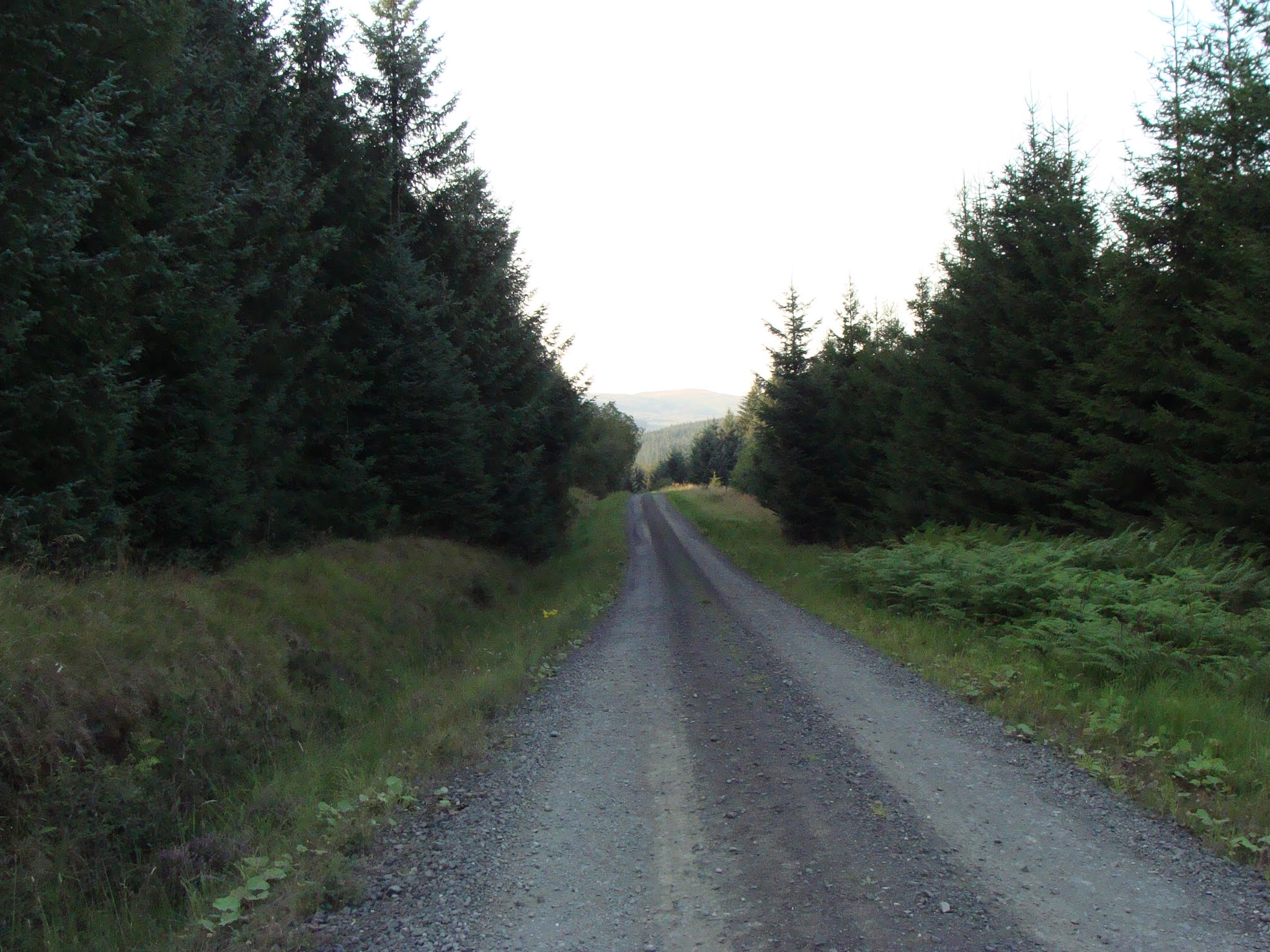
I woke to another beautiful morning, starting with a pleasant walk along the river Rede, then across the road and up through the forest. This was a steep climb up, ending in a scramble up the crag near the top. Finally I was on the border ridge which would take me all the way to Kirk Yetholm in Scotland.
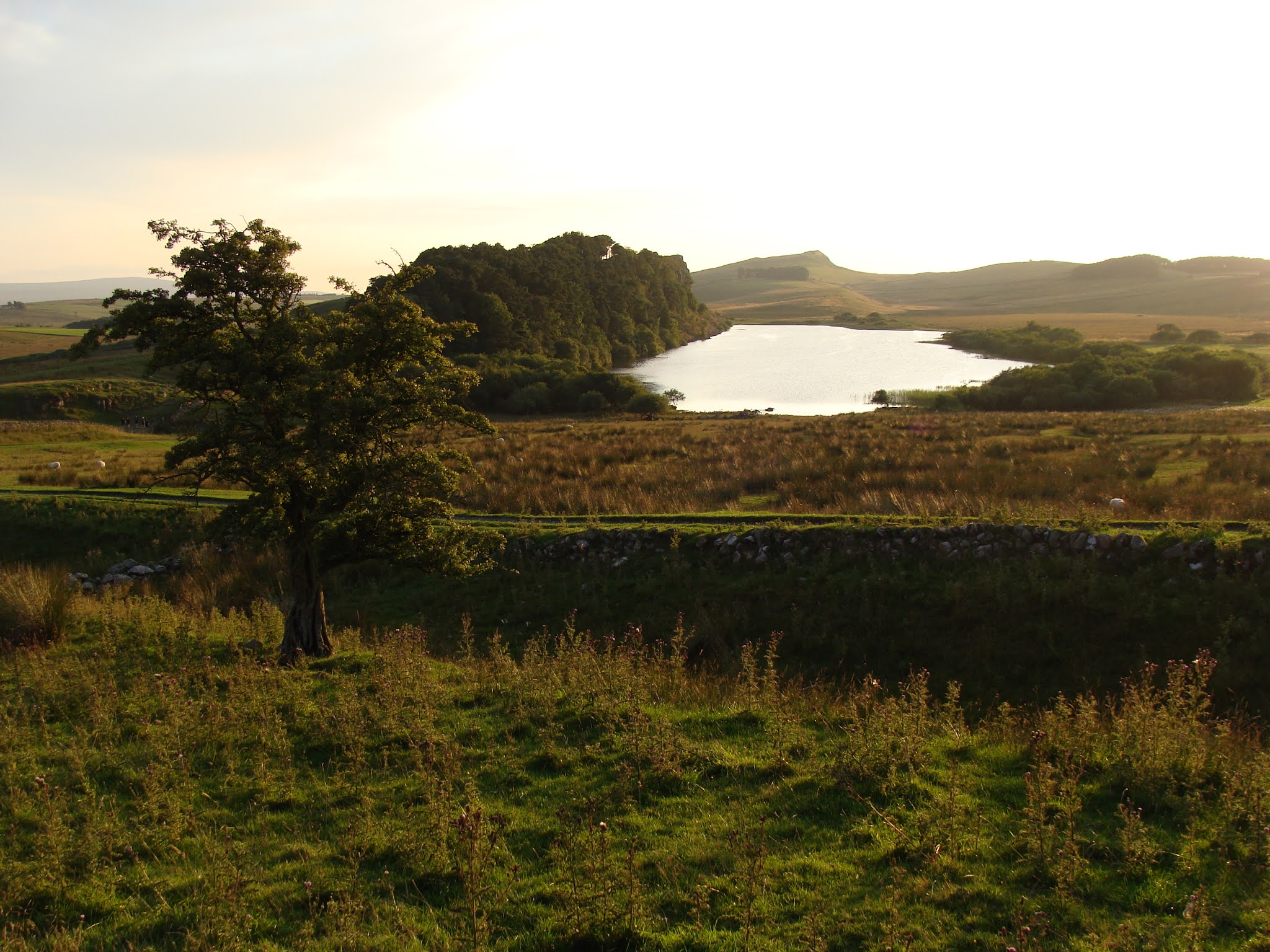
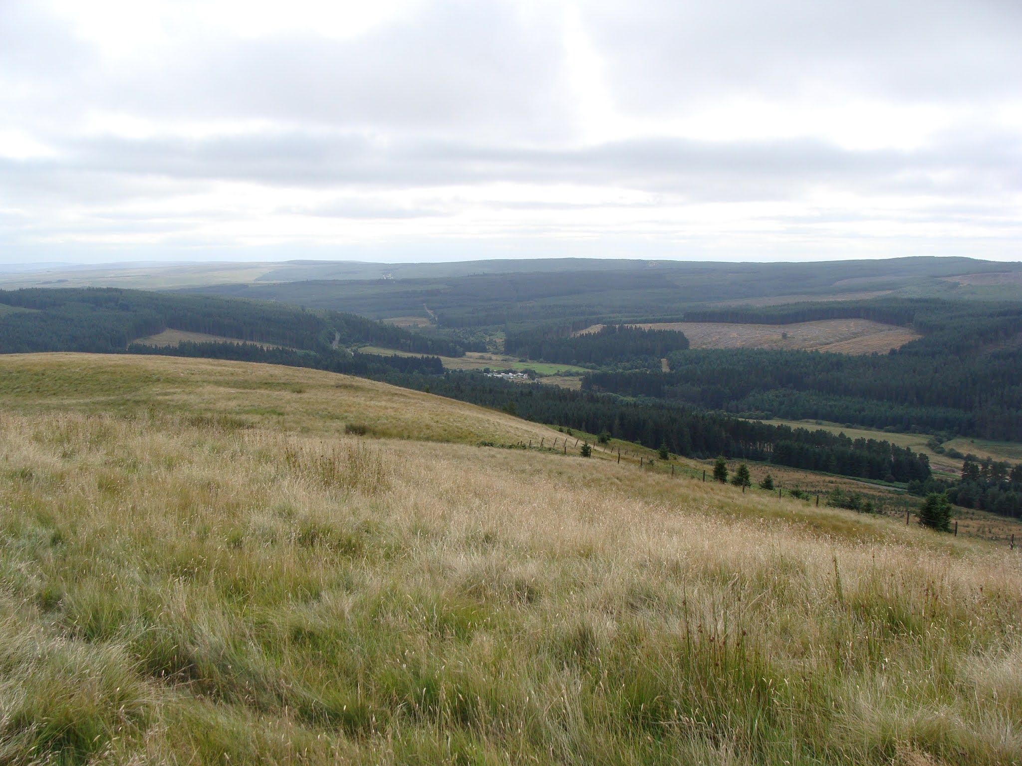
After yesterday's 14 miles, I promised myself to do just 9, divided into threes. to help my feet. The route from Byrness Hill to Chew Green (Roman fort) was a lovely walk ascending and descending various small summits with great names on a soft grassy trail. To the south the northern Pennines stood proud on the horizon, to the west Kielder Forest spread out from horizon to horizon, to the east more purple and green hills.
I first stopped at Windy Crag and sat on a comfy rock where someone had left half a baguette. I left the food for the scavengers and put the wrapper in my pack. Next came Ravens Crag and Ogre Hill, and a little bit of Scotland, before heading east to the roman camp and fort at Chew Green. I had a sit down on the grassy ramparts, aired my feet, had lunch and filled a water pouch with sheep-poo tainted water from under a footbridge.
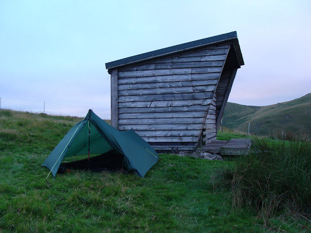
After Chew Green a relatively easy trail took me to Yearning Saddle bothy. This is a small wooden hut set high up in the hills overlooking the Hymers Gap. I pitched the tent but put some of my stuff inside the hut where I filtered water, cooked and ate dinner by candle-light. Dusk brought a cold wind and I was glad I had my insulated jacket and down sleeping bag. No ogres, Romans or lost hikers disturbed my sleep.
(I'd only seen 4 people (3 walkers and a farmer) all day.)
 |
| Byrness (Forest View camping field) |
 |
| Byrness (Forest View campsite) |
 |
| Byrness |
 |
Byrness (St Marks)
|
 |
| Byrness (high up in the forest) |
 |
| Byrness Hill (the crags) |
 |
Byrness Hill (Redesdale Forest and Catcleugh Reservoir)
|
 |
| Byrness Hill (the campsite middle-left). |
 |
| Byrness Hill (looking at Redesdale Forest) |
 |
| Army practice terrain |
 |
| Army practice terrain |
 |
| The Border Ridge |
 |
| The Border Ridge (looking at Redesdale Forest) |
 |
| The Border Ridge (Byrness Hill) |
 |
| The Border Ridge (the Otterburn military practice area) |
 |
| The Border Ridge |
 |
| The Border Ridge |
 |
| The Border Ridge (Windy Crag) |
 |
| The Border Ridge (looking back) |
 |
| The Border Ridge (Ravens Pike (?) |
 |
| Wasps sheltering in holes in the rocks |
 |
The Border Ridge (a little bit of Scotland)
|
 |
| The Border Ridge |
 |
The Border Ridge (Chew Green - Roman Fort)
|
 |
| The Border Ridge (Chew Green) |
 |
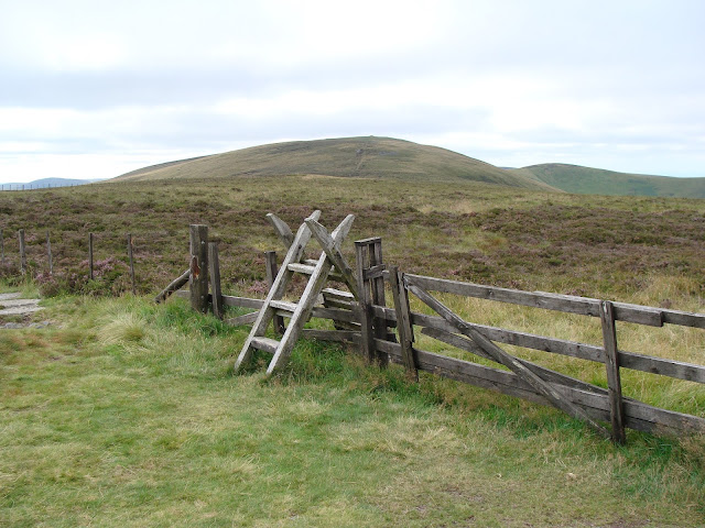
| The Border Ridge (the border fence) |
 |
| The Border Ridge (looking north-east towards the Cheviot) |
 |
| The Border Ridge (walking towards Yearning Saddle Bothy) |
 |
| The Border Ridge (inside Yearning Saddle Bothy) |
 |
| The Border Ridge (Yearning Saddle Bothy) |
 |
| The Border Ridge (Yearning Saddle) |
 |
| The Border Ridge (Yearning Saddle) |
 |
| The Border Ridge (Yearning Saddle) |
Day five: Yearning Saddle to Auchope 12 miles.
Weather: cloudy, sunny spells, warm, light breeze, cold on summit.
A day of: many hills, rocky cairns, views into Scotland.
Highs:
- Good weather
- Great views
- Friendly/helpful hikers
- Nice camping spot
- fantastic sunset
Lows:
 |
| PW5 day 5 |
 |
| PW5 day 5 |
Diary day five: hills and summits.
This was going to be a shorter day or a longer one depending on my feet. I found that after walking several miles the discomfort was bearable and it was better not to stop too long or take boots off during breaks.
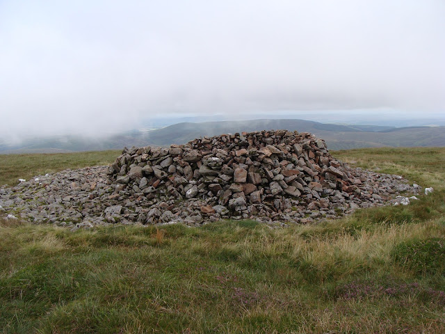
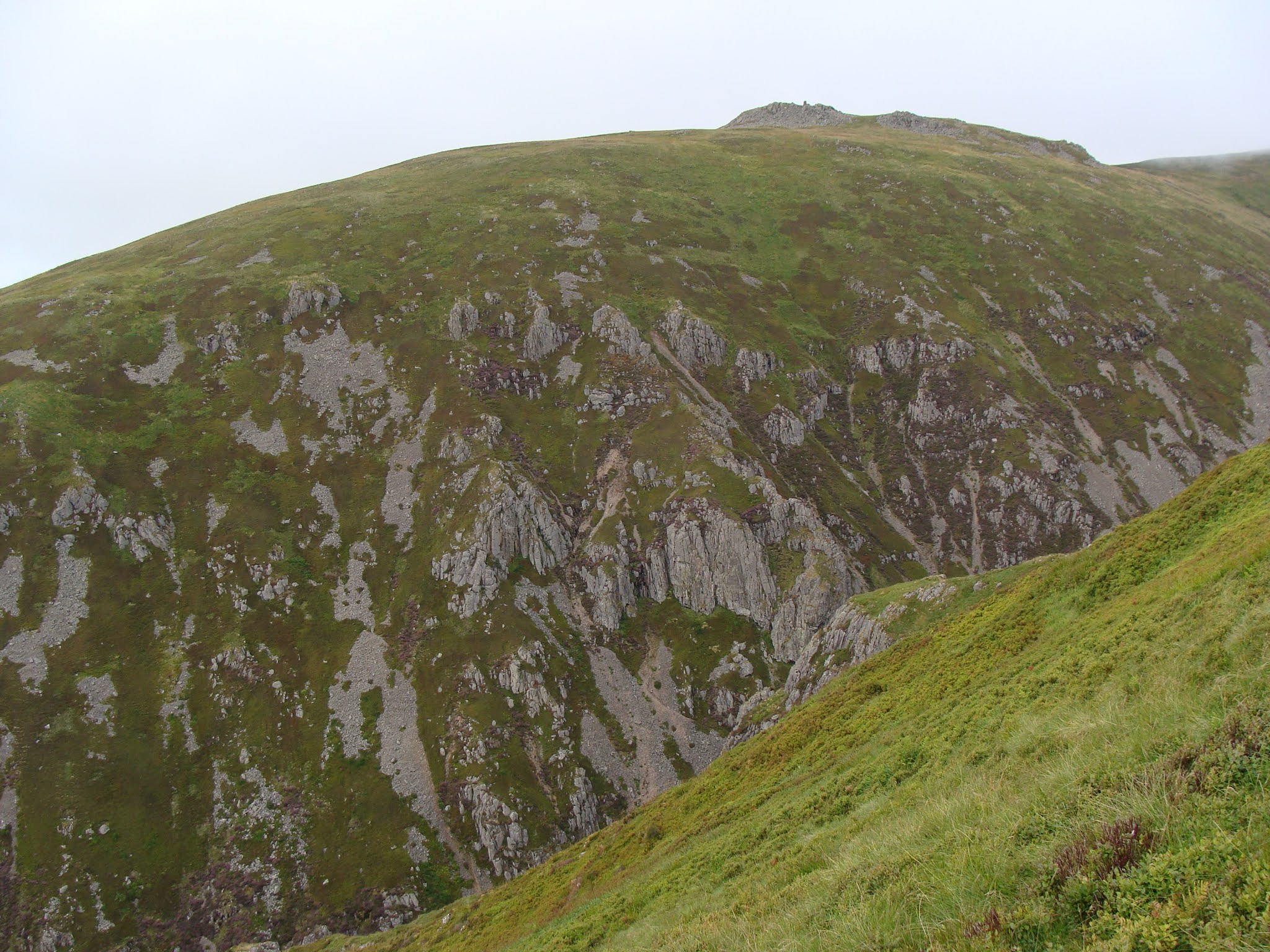
So I walked on and on to Windy Gyle, managed to bypass the summit, so made a short detour back. Windy Gyle is a fine summit with a cairn and trig-point. The views from here are fantastic and would provide a good camping pitch on a calm day. Then on to Kings Seat and Cairn Hill where you can turn off to walk up the Cheviot (815m).
Somewhere along the border fence I'd stopped for water and a brief break, and got talking to a young couple who'd walked from Byrness doing half the PW. They kindly gave me a few snacks when they found out I was low on food. Both were keen to push on to Kirk Yetholm to finish their walk.
The Cheviot had been in and out of cloud all day though still dominating the view ahead. A steep walk up brought me to the path junction and I did not hesitate to turn right and walk the 1.25 mile to the summit. I would not have forgiven myself not bagging this summit, my 150th Nuttall.
The walk up is on big slabs across boggy/grassy areas till you reach the big white trig-point mounted on a concrete plinth. This provided a good place to sit and have a short break. A couple dressed in warm jackets just left while another joined me, sweating in summer tops. They soon put on a warm layer to combat the cold northern breeze blowing across the summit plateau, before heading back down again.
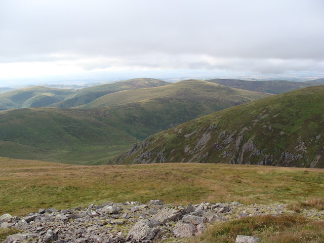
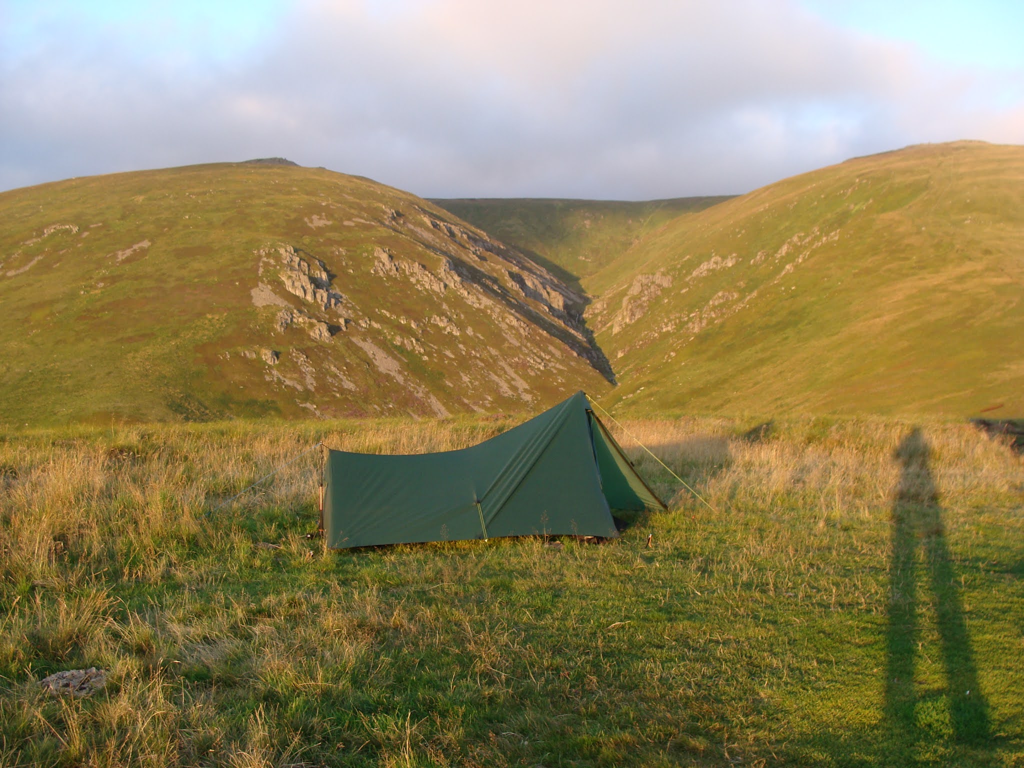
Pleased with my effort I decided to walk to the next mountain bothy at Auchope a few miles further. I hadn't quite anticipated the 200 m descent from Auchope Cairn, but I was in good spirits as the scenery was fantastic. Hen Hole is a dramatic gorge with a stream rushing through, and again the views all round were great.
Before I got to the hut I realised I needed water. I'd passed a lot of decent bog ponds but hadn't filled up thinking there would be more nearer the hut. Unfortunately there were only boggy puddles containing cow-poo tainted water.
I got to the hut in time to pitch the tent, organise my stuff, explore the hut, filter water, cook dinner and make a hot drink, before sitting down to watch a dramatic sunset over Scotland.
I watched the wind turn 180* but wasn't bothered as there was little wind forecast. No curious cows trampled the tent in the night.
(I saw 8 people all day, 6 day hikers and 2 PW backpackers.)
 |
| The Border Ridge |
 |
| The Border Ridge (broken path) |
 |
| The Border Ridge (Mozie Law) |
 |
The Border Ridge
|
 |
| The Border Ridge (looking east?) |
 |
| The Border Ridge |
 |
| The Border Ridge (Windy Gyle) |
 |
| The Border Ridge |
 |
Windy Gyle
|
 |
The Border Ridge
|
 |
| The Border Ridge (Windy Gyle/Russel's Cairn) |
 |
| The Border Ridge (looking towards the Cheviot) |
 |
| The Border Ridge (looking north west). |
 |
| The Border Ridge (Kidland Forest) |
 |
| The Border Ridge |
 |
| The Border Ridge (the Border Junction) |
 |
| The Border Ridge (looking at the Cheviot) |
 |
| The Border Ridge (Kings Seat Trig-point) |
 |
| The Cheviot |
 |
| The Border Ridge |
 |
| The Border Ridge (the junction to either Auchope or the Cheviot) |
 |
| The Cheviot |
 |
The Cheviot Trig-point
|
 |
| The Cheviot (Cairn Hill) |
 |
| The cheviot |
 |
| The Border Ridge (Hen Hole from Auchope Cairn) |
 |
| The Border Ridge (Hen Hole from Auchope Cairn) |
 |
| The Border Ridge (the Cheviot from Auchope Cairn) |
 |
| The Border Ridge (Auchope Cairn) |
 |
| The Border Ridge (views north-west from Auchope Cairn) |
 |
| The Border Ridge (Hen Hole from Auchope Cairn) |
 |
| The Border Ridge (Hen Hole from Auchope Cairn) |
 |
| The Border Ridge (Hen Hole from Auchope Cairn) |
 |
| The Border Ridge (Hen Hole from Auchope Cairn) |
 |
| The Border Ridge (the Shill from Auchope) |
 |
| The Border Ridge (walking towards Auchope Bothy) |
 |
| The Border Ridge (Auchope Bothy) |
 |
| The Border Ridge (Hen Hole from Auchope) |
 |
| The Border Ridge (Auchope Bothy) |
 |
| The Border Ridge (views from Auchope Bothy) |
 |
| The Border Ridge (views from Auchope Bothy) |
 |
| The Border Ridge (my tent at Auchope) |
 |
| The Border Ridge (my tent at Auchope) |
 |
| The Border Ridge (my tent at Auchope) |
 |
| Auchope Bothy (filtering water) |
 |
The Border Ridge (sunset over Scotland)
|
Day six: Auchope to Kirk Yetholm 7.2 (+2) miles.
Kirk Yetholm - Town Yetholm - Kelso - Berwick on Tweed.
Weather: mostly sunny, warm, light breeze.
A day of: more hills, limping into Scotland, food dramas, a kind lift, a fun bus-ride and sick by the seaside.
Highs:
- Good weather
- Great views
- Finishing the walk
- A nice certificate
- Kind strangers
- A phone-call from my partner
- Take-away food
- A nice place to camp
Lows:
- A very sore foot
- Very tired
- No food at the Inn
- Unwell in the night
 |
| PW5 day 6 |
 |
| PW5 day 6 |
Diary day six: a sting in the tail.
I woke to a beautiful morning and watched the sun-rise over West Hill. Only 7 miles to Kirk Yetholm, a pub dinner and a pint, and a comfy pitch at the campsite in Town Yetholm.
A steep ascent took me up the Shill, another fine summit with a wind-shelter built on a rocky outcrop. Then down to Black Hag where a choice must be made between the high and the low route. I stupidly played it tough and chose the high route, not realising how steep White Law actually is, especially with sore feet and under a hot sun.
Somehow I dragged myself up its grassy summit before starting the descent into Kirk Yetholm. One well-known sting in the tail is the last hill on the lane just before the village. It really was a tough little hill that tested weary legs and sore feet.
I saw quite a few people today, day hikers, runners and a few PW hikers going north to south. Before ascending White Law, I had a chat with an elderly lady who'd walked much further than intended, as this kind of nice weather is quite rare up in the borderland.
Then I was entering the village, quaint cottages lining the lane, the village green busy with day trippers and a few hikers, and the Border Hotel where fame awaits in the form of a certificate, your name in the PW book, and a free half pint.
But tradition and pride dictated first touching that famous wall next to the defibrillator and the wooden plant-pot, where several Montane Spine racers have sat, exhausted by their super-human efforts. Watched by a few curious onlookers, I did touch and kiss that wall before collapsing, not in the plant-pot, but on a picnic bench.
Soon after I went inside and asked about food. "No we stopped serving at 2 and won't be serving till tomorrow" said the bar staff politely. I bought some cake and half a Black Hag beer then sat down, texted home and plotted my next move.
After taking a few pictures I set off for Town Yetholm across the river in search of either a shop or a pub. Unfortunately both were closed but a kind woman offered a lift to Kelso. That meant I could catch a bus to Berwick on Tweed then take the train home on Sunday.
In Kelso I had some much needed lunch on a bench in the town square before catching a bus to Berwick. While waiting, I received a nice phone call from my partner, congratulating me on completing the journey. I shared the bus with a group of elderly ladies who kept me entertained with their chat and gossip.
In Berwick I bought a take-away (cheese burger and chips) which I ate on a bench overlooking the sea. As my feet refused to walk any further I decided the patch of grass by the bench, just out of sight of the main path, was perfect to spend the night. I enjoyed a quiet evening of watching and listening to the waves rolling in and seabirds calling.
Day seven: Going home.
I was unwell in the night, my body rejecting the rich food I ate the day before. Later, on the way to the train station, I bought lunch (sandwiches), then boarded the Cross-Country train to Birmingham. Around 5pm I arrived back in my hometown, looking forward to hugs, a roast dinner and a long hot shower.
 |
| The Border Ridge (early morning at Auchope) |
 |
| The Border Ridge (Auchope Bothy) |
 |
| The Border Ridge (Auchope Bothy) |
 |
| The Border Ridge (Auchope) |
 |
The Border Ridge (sunrise over West Hill)
|
 |
| The Border Ridge (the hills on the High Route) |
 |
| The Border Ridge (looking towards Mounthooly) |
 |
| The Border Ridge (going up the Shil (+ a heather fly) |
 |
The Border Ridge (going up the Shil)
|
 |
| Berwick on Tweed (my camp by the sea) |
 |
| The end of the journey |
Taz, summer 2021
➖➖➖➖➖➖➖➖➖➖➖➖➖➖➖➖➖➖➖➖➖➖➖➖➖➖➖➖➖
This had been quite a tough trip, made hard by a painful right foot due to new boots not fitting well, an arm which was still healing, and having to carry quite a bit of food and water.
All the training I put in paid off, my legs were okay throughout the trip. The weather was very good, and the stunning views and nice people I met made up for the pain.
I had felt slightly awkward about doing the PW in sections and at a relatively slow pace, averaging 10-12 mile p/d, but now it's finished I realise it's been an excellent way to do it. I enjoyed plotting each section, and it's given me something to look forward to every summer. I enjoyed every stretch, and not felt I rushed through it, though it was often quite a long slog.
What's next? I don't know. Will I do it again? Possibly.
Kit list:
- Backpack: Granite Gear Blaze 60L
- TN Laser 6L waist pouch
- Tent: Trekkertent Stealth 2
- Sleeping bag: Alpkit PD600
- Sleeping mat: Alpkit Numo
- Sit-mat: short OEX roll-mat
- BD Trail trekking poles
Cook:
- Speedster Stove
- Alpkit ti mug 650 ml
- Ti spoon + spare small spork
- Wildo big cup/mug
- Cheap BBQ lighter
- 350ml of ethanol in 2 small bottles
- Three 1L water pouches
- 1 small cup + 1 small bottle
- Sawyer Squeeze filter kit
- Wash kit
- Toilet kit
- Repair kit
- Pen-knife
- First Aid
- Two large Vango dry-bags
- Large Alpkit drybag (for tent)
- Small drybag (for camera)
- Silnylon stuff-sacks
- Mobile phone
- Camera + extras
- MP3 player
- Silva head-torch
- Spare batts
Clothes (mostly) worn:
- Undies
- Nike running t-shirt
- Lightweight walking trousers (Mountain Warehouse)
- Either 1 pair of hiking socks or 2 thin pairs of socks
- Rab VR Lite top
- Running cap or buff
- Spare clothes (1 thin leggings, 1 thin t-shirt, 2 undies, 3x socks)
- Other clothes (insulated jacket, liner gloves)
- Salomon X Ultra Mid boots
The boots were too narrow for my feet especially the right one. They did keep my feet dry, were light and had good tread.
- Rab Vidda jacket
- Rab Trousers
Food:
- Muesli-mix (breakfast & lunch)
- Home-made dehydrated meals
- Chocolate
- Dried fruit
- Chorizo
- Teabags
- Snacks bought along the route
Waterproof were not needed.
Base-weight was around 8.5kg except clothes worn and trekking poles.
Food and water varied from 0.5 kg to 4 kg.
.JPG)


.JPG)
.JPG)
.JPG)
No comments:
Post a Comment