Back on the PW after a year’s absence due to a knee injury.
Daily mileages were kept shorter to be on the safe side (10 miles p/d average on full days) and were also dictated by where I could safely wild camp or refuel.
I rather walk it slowly and enjoy it, than overdo it and risk more injuries. At the end I felt I could happily walk a bit further and faster, but commitments meant I needed to go home.
As usual, some changes to the route were made to either join up the previous route with the next one, to make the route more interesting or to find a good place to camp, but never to make the route shorter or much easier.
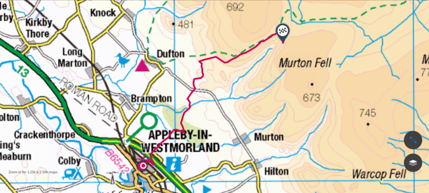
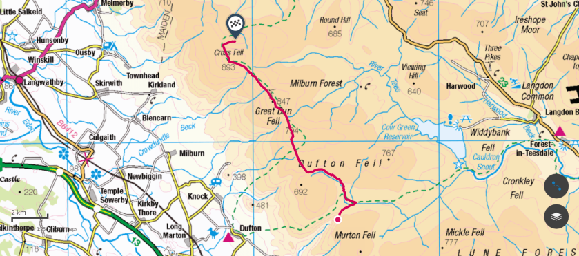
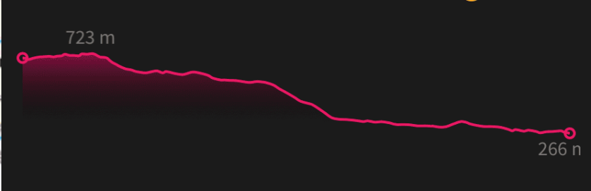
The route from Appleby to Greg’s hut on Cross Fell is approximately 13.7 miles, the route I walked is about 16.2 miles. Even though I did miss out a short stretch of the PW, I didn’t walk fewer miles.
I really wanted to see High Cup in good weather and camp near it. I didn't want to descent into Dufton on day 2, only to climb back up again purely to stick to the PW route.
Backpack base-weight was 8.5 kg.
Food and water varied between 1 kg and 4 kg.
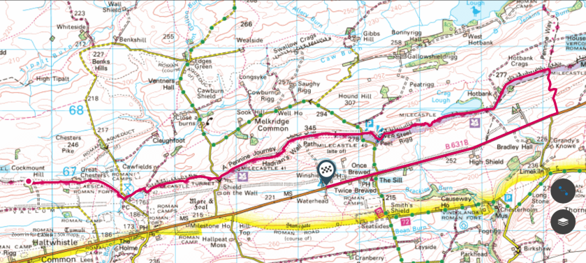
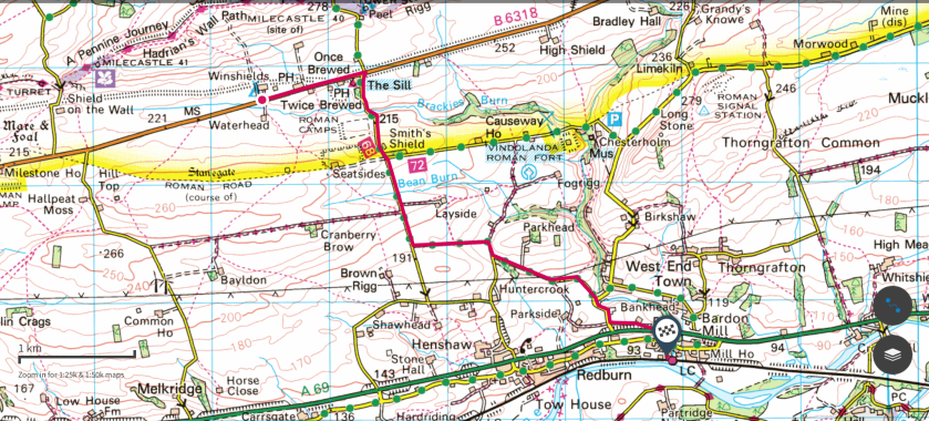
PW distance from Dufton to Housesteads: 53 miles.
(Photos were taken using a Sony Cybershot camera and a mobile phone)
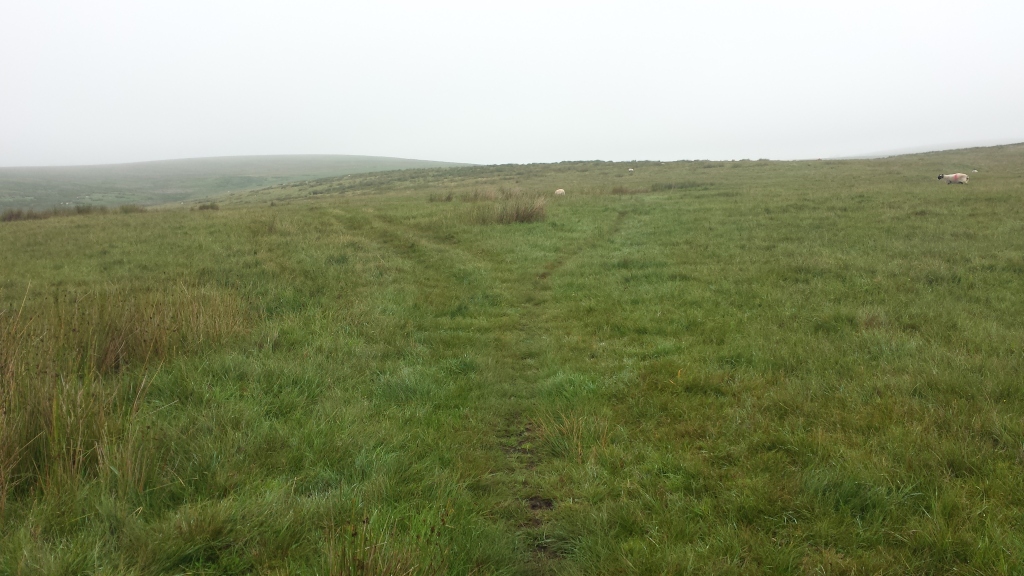
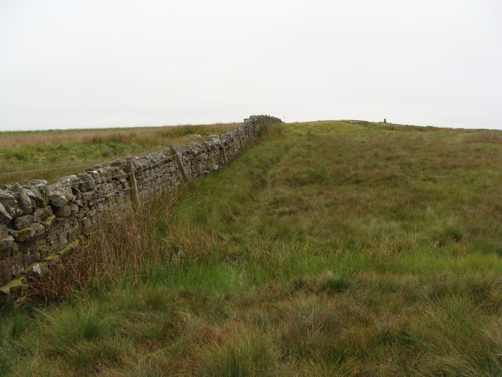
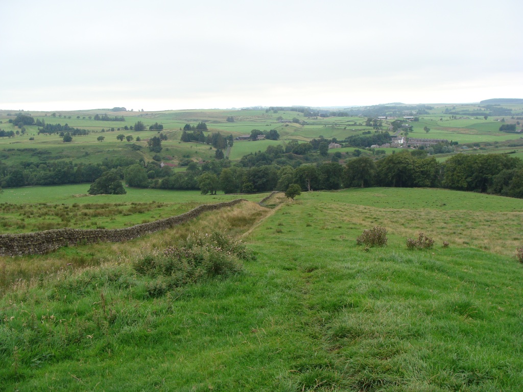
PW4 route
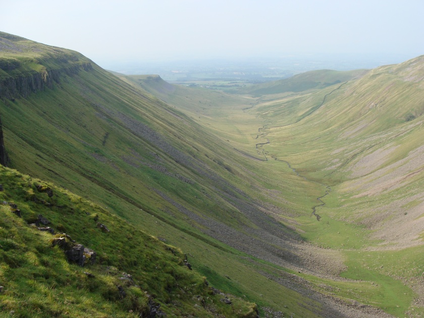
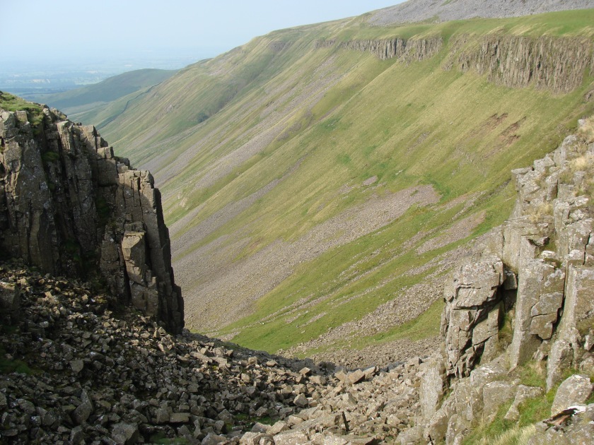
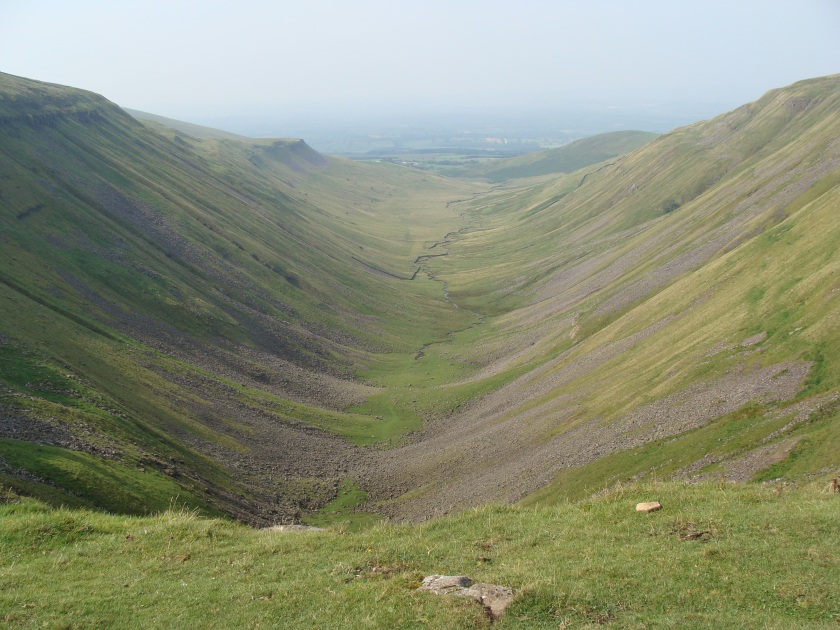
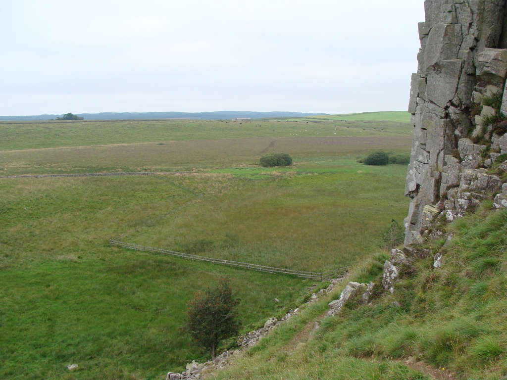
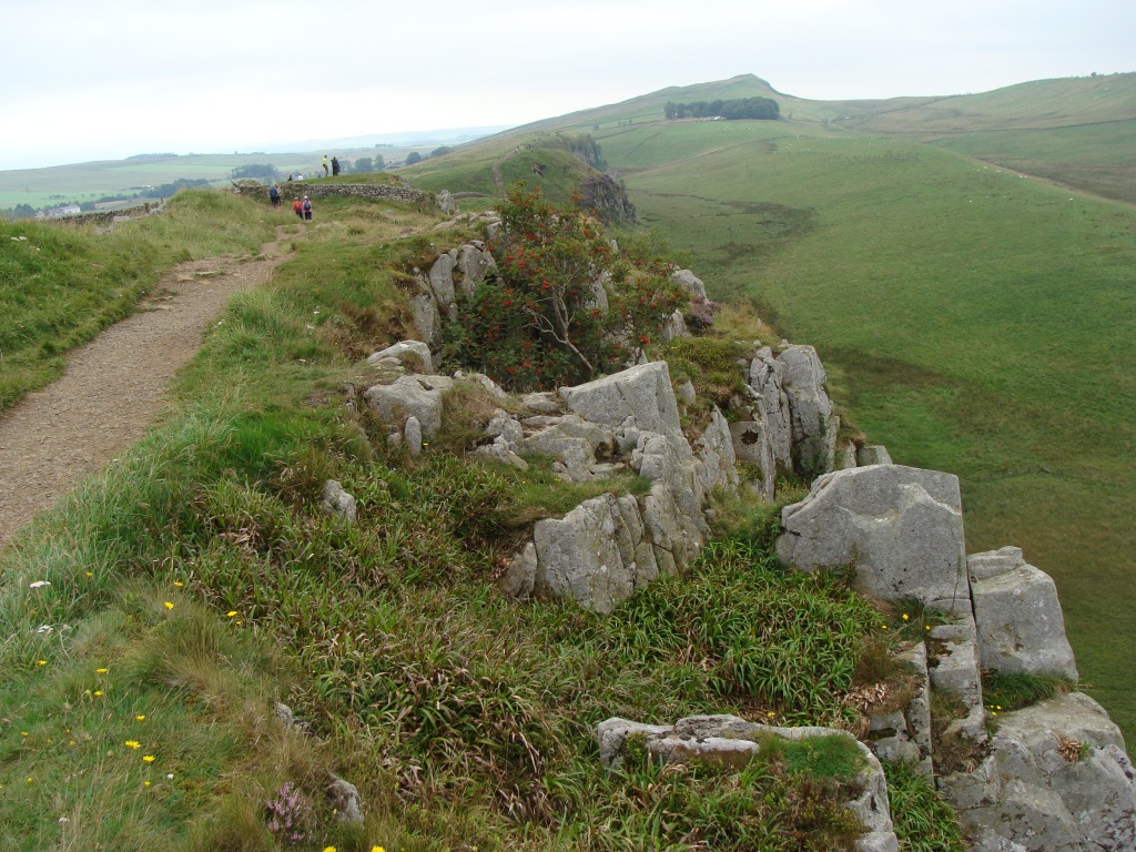
High Cup
Cross Fell
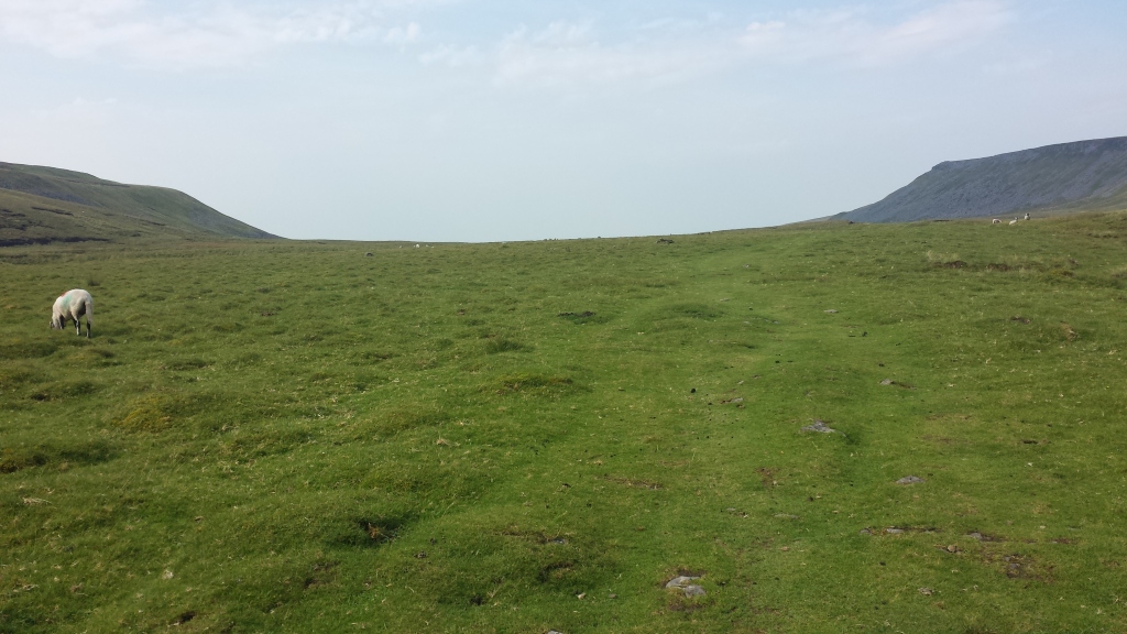
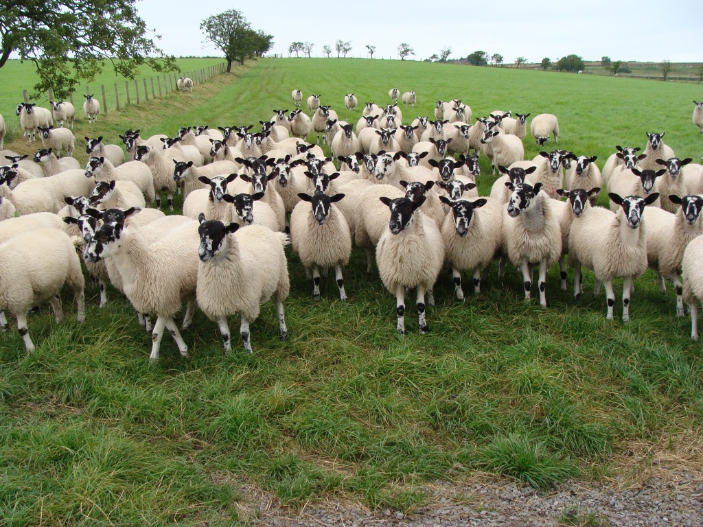
Woolly friends
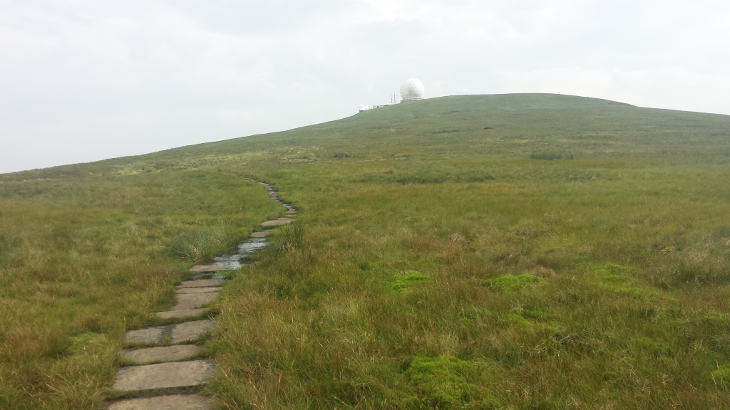
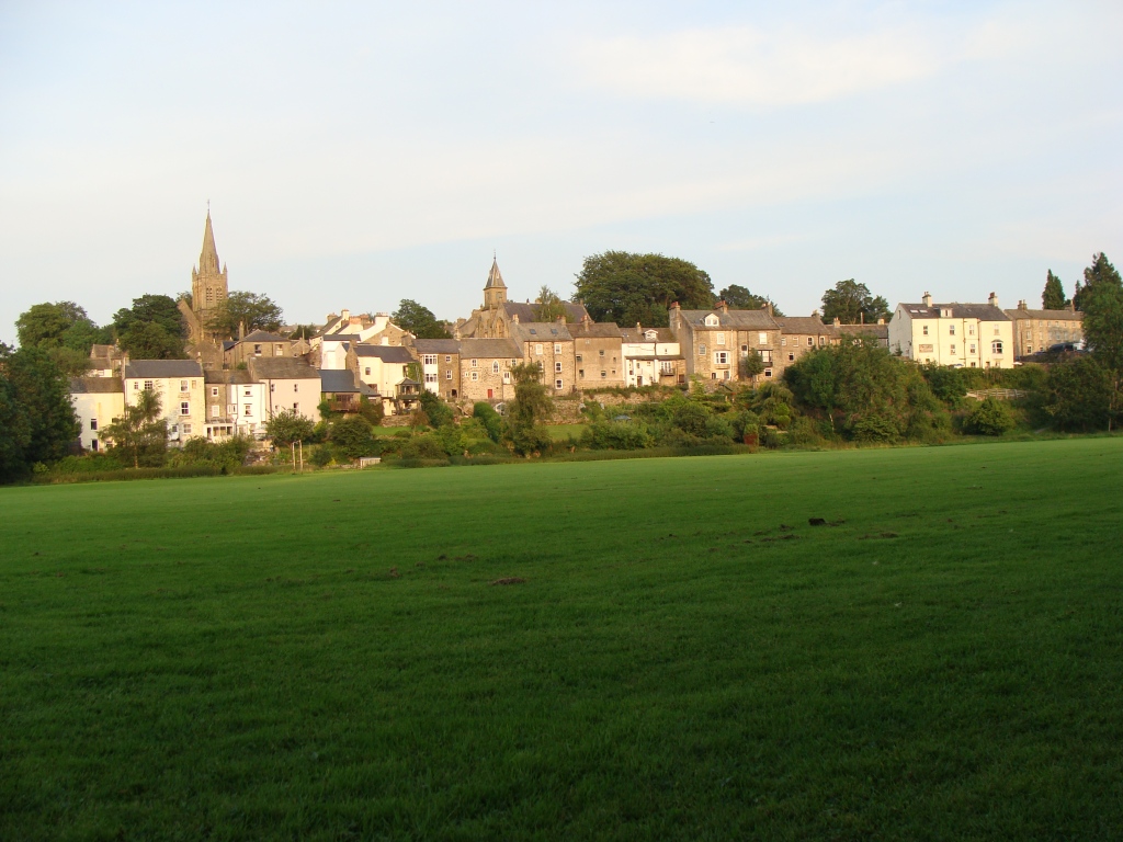
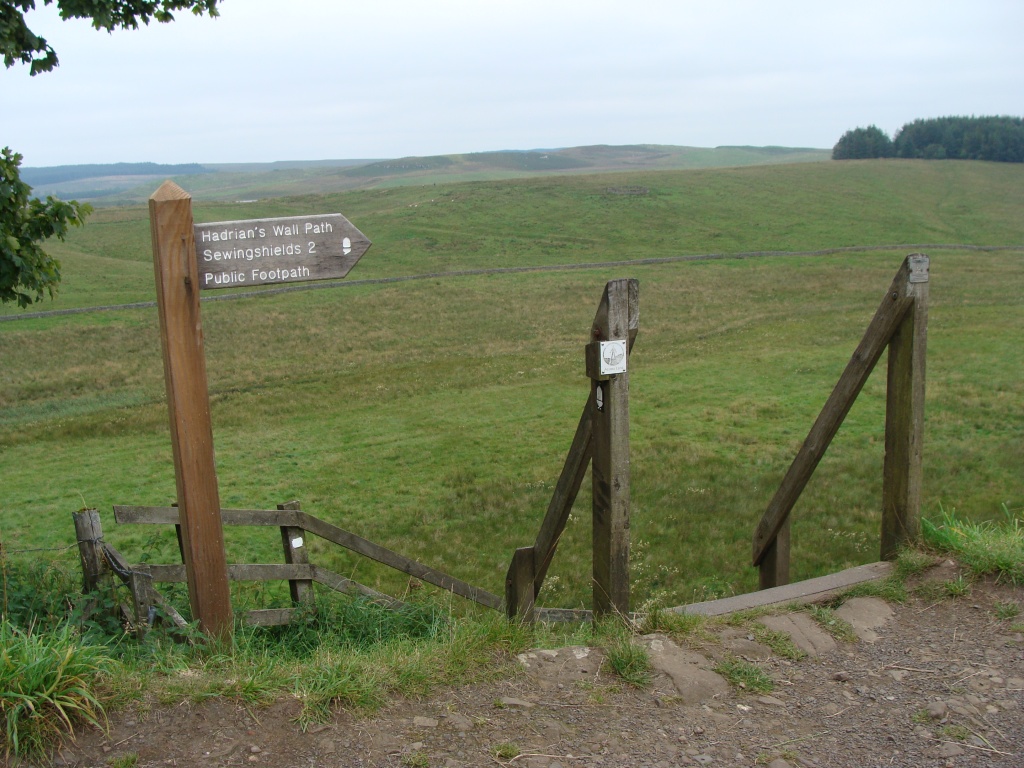
Day one: Appleby–in-Westmoreland to High Cup (Nick) 7 miles.
Weather: sunny, hot and humid, thunder and lightning.
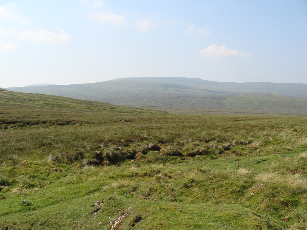
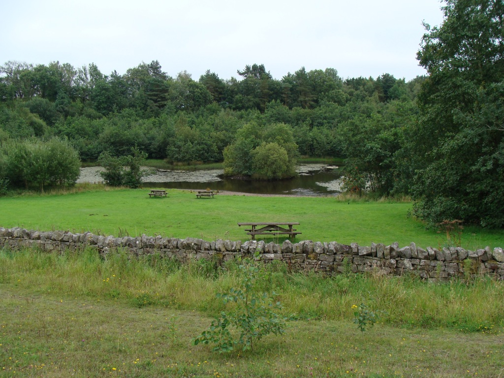
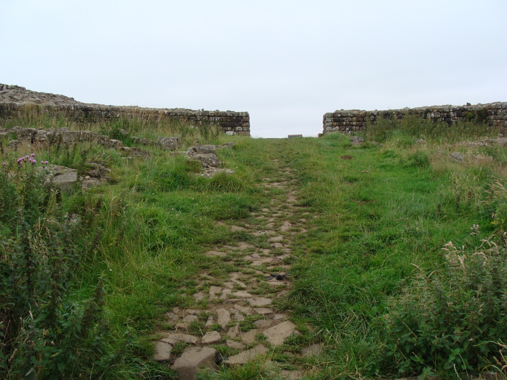
A day of: easy train travel, a hot hike across fields and through woods, then uphill to the stunning ravine of High Cup set high above the Eden valley, where an uneasy night was spent watching the lightning and listening to thunder rumbling, with wild ponies for company.
Highs:
no rain, cloud or fog
fantastic views of the big Pennine summits
a camp with an amazing view
Lows:
hot and humid weather
some sunburn
aches & pains
PW4 day 1
PW4 day 1
Diary day 1: trains and thunder.
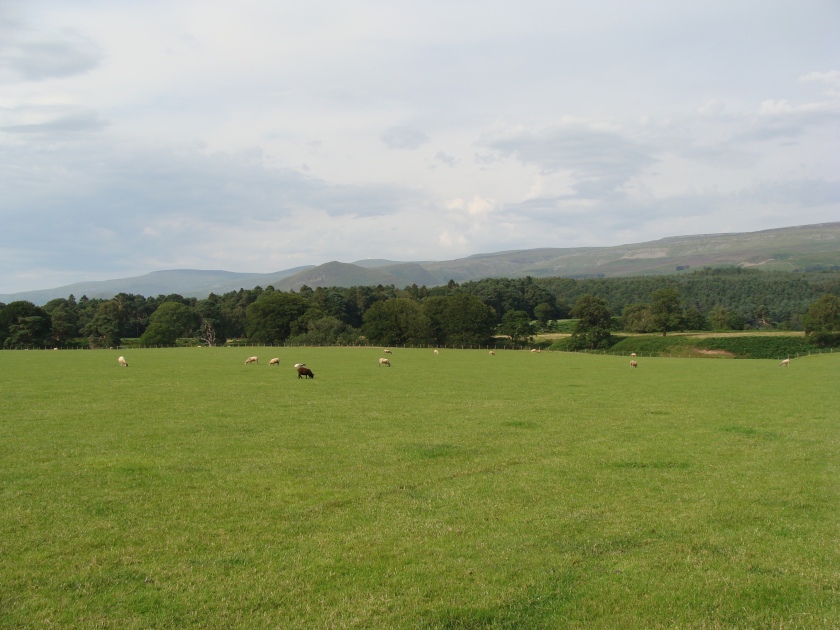
I got up early to catch the morning train to Appleby-in-Westmoreland, a trip of 5 hours and 200 miles north. The train journey was nice, despite no food sales on the platforms and having to wear a face-mask. It was not busy and there were plenty of empty seats and space to have my backpack near me. Good weather meant great views of the countryside. Excitement increased when the high Pennine fells could be seen through the window on the last section of the journey.
My fair-weather plan was to either take a taxi or walk the 4 miles to Dufton, have some dinner, then walk up to High Cup to camp. In case of rain or fog, I would camp in or near Dufton, then walk up Knock Fell in the morning. In the end I walked straight to High Cup via Keisley, as it would've been too late to eat in the cafe, and camped overlooking the Eden valley.
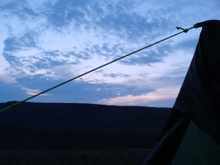
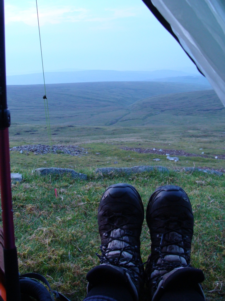
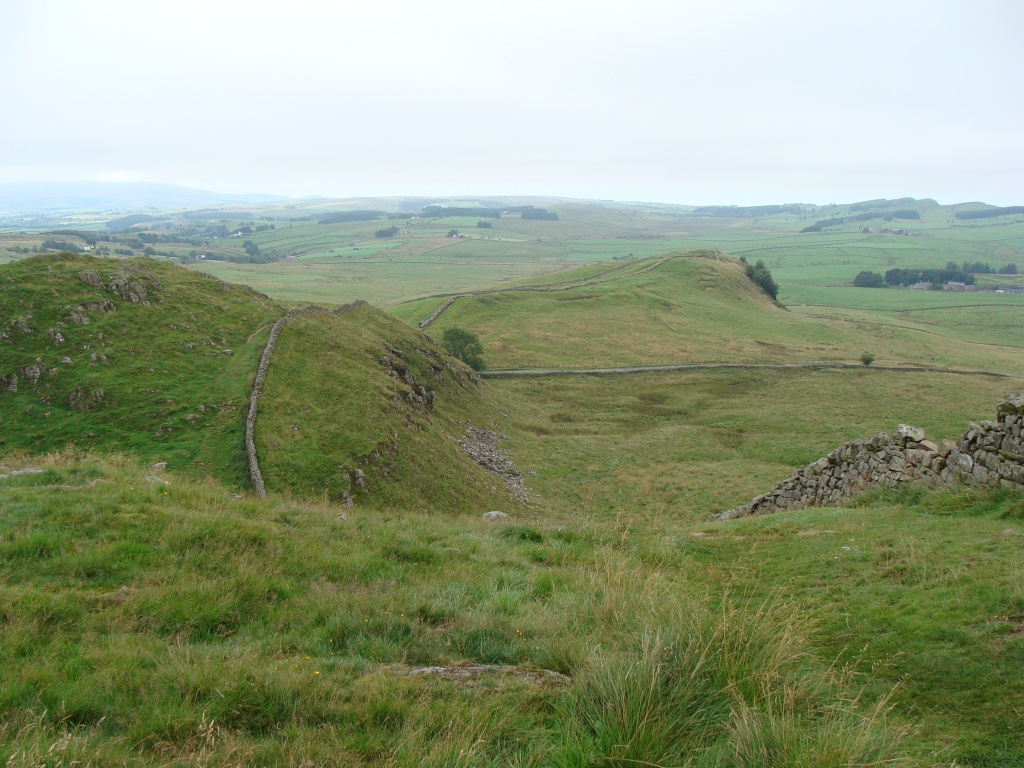
It was a tough few miles following the Pennine Journey trail across fields, through woods and up the fell, my body not used to the 12 kg bag and struggling a little in the summer's heat. It was all worth it when the views started to open up, revealing the deep valley of High Cup as daylight was slowly fading. A few pics and clumsy selfies were taken at the head of the valley, where last time only thick cloud was seen. Then on to find somewhere nice to camp before dark.
A thunderstorm hung further west over the Lake District and was slowly drifting east, promising an interesting night. After finding a suitable spot, the tent was pitched on soft mossy grass away from the valley's sheer drop. Dinner was cooked on the little meths stove and eaten as the stars came out. The thunderstorm did visit in the night, giving me, and the wild ponies who slept nearby, a good light-show accompanied by the rumbles of Thor's hammer.
Walking from Appleby to Keisley with the high Fells ahead.
The track up to High Cup from Keisley
Reaching High Cup
Seeing the view for the first time in fading light
Watching the sun set from the tent
Day two: High Cup to Greg’s Hut on Cross Fell 9 miles.
Weather: sunny, hazy, hot and humid. Thunder and lightning.
A day of: bog-hopping and a roller-coaster across the high fells, fantastic views of a managed but fairly remote landscape, sweating buckets and drinking gallons, and a well-earned curry in Greg's Hut.
Highs:
fantastic views all day
watching a short-eared owl hunt
good joining up with the actual PW on Knock Old Man
walking over Crossfell in good weather
meeting seasoned PW hiker B
a camp with great views across the northern Pennines
Lows:
very hot and humid weather
sore feet
Dubious delight:
My new-found hiker companion enjoyed listening to radio podcasts using a small speaker. So I found myself eating a chicken curry, outside a remote mountain bothy, with the sky turning different shades of oranges and pinks, listening to an episode of Steptoe & Son.
PW4 day 2
PW4 day 2
Diary day 2: fells and views.
It was fantastic waking to sunshine and potentially having a day of great views. A lone figure appeared in the distance, possibly a PW hiker heading for Dufton. I snapped a picture, zooming in as the hiker was a long way off.
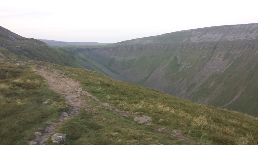
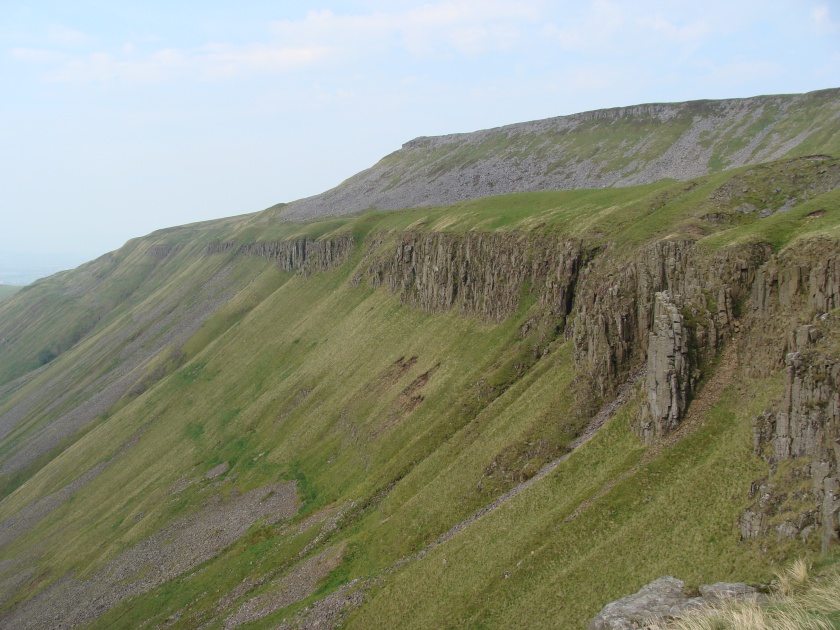
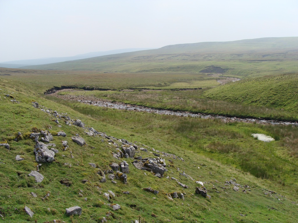
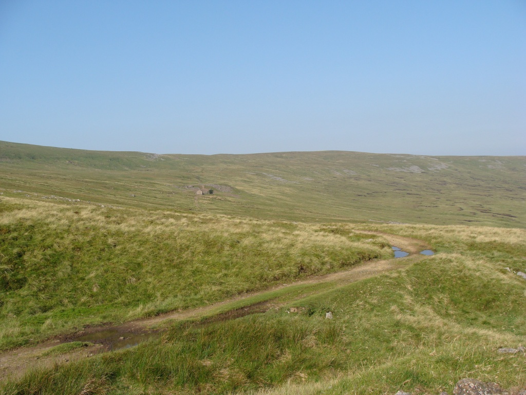
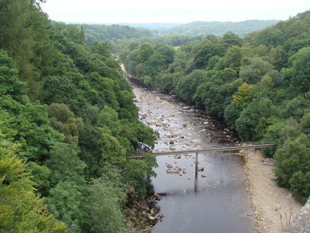
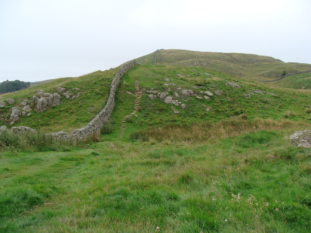
After the morning camp routines, I set off along the rim of the valley, taking many pictures and enjoying the views. I followed the PW east to the footbridge at Maize Beck scar, a small limestone gorge I didn't see last time. From there I followed a faint trail that runs next to the stream across the moor to Great Rundale Tarn, a lake on the Dufton Fell. Despite a few initial worries, this was a relatively easy hike on moorland with little chance of getting lost.
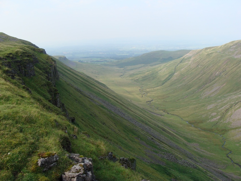
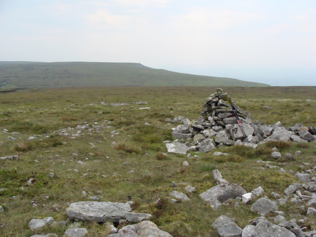
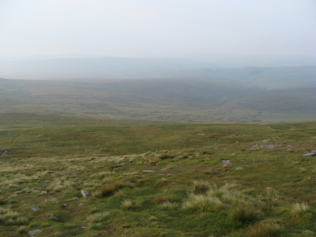
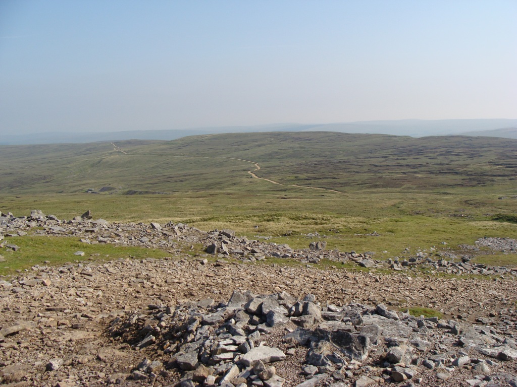
Views south revealed impressive vistas of the Lune Forest Fells further south hazily rising up above the moors. After reaching the tarn and the hut I headed north to High Scald fell, a grassy lump rising above the rough and boggy moorland. From High Scald I ascended to Knock Fell, aiming for the currick (a tall cairn) standing proud on the fell's summit. On Knock Fell I rejoined the PW again, giving me a feeling of satisfaction and purpose.
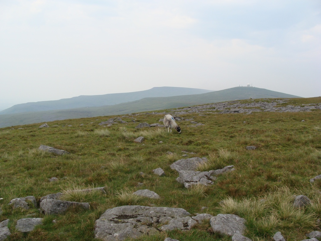
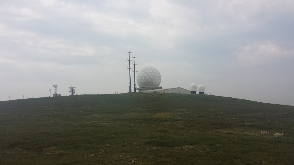
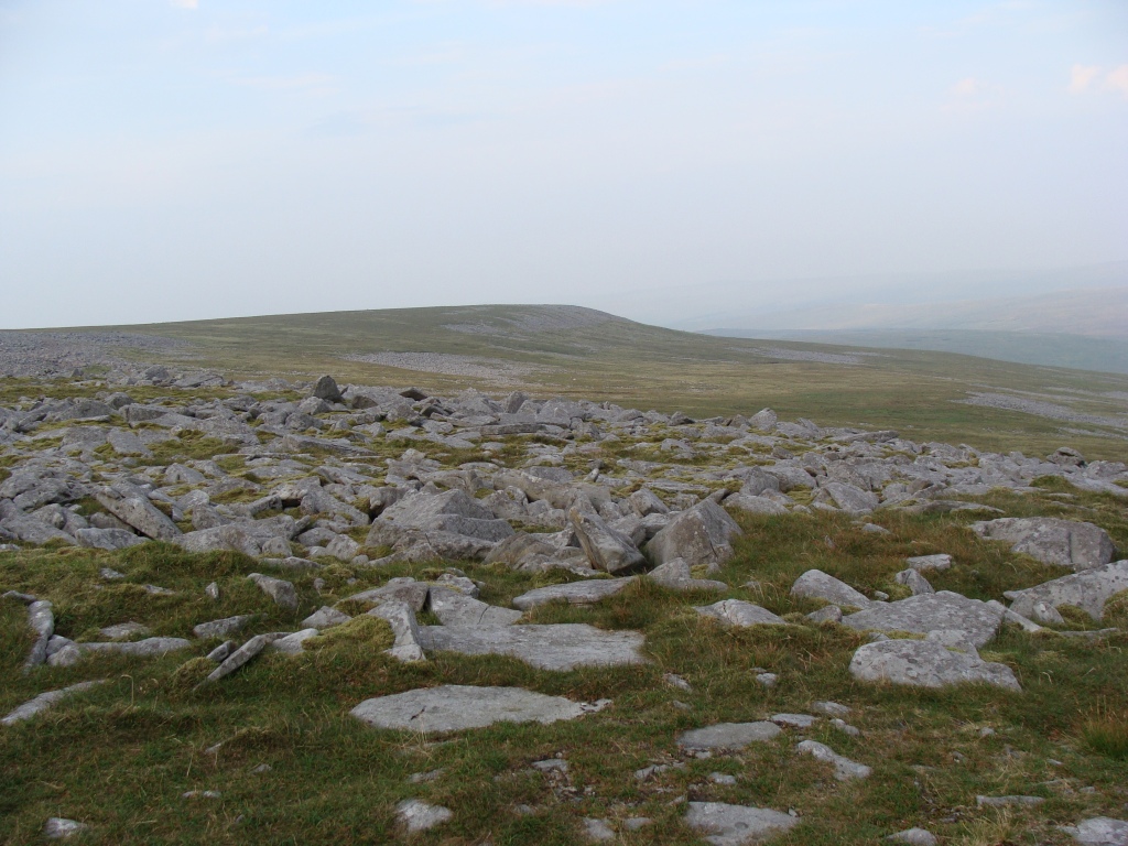
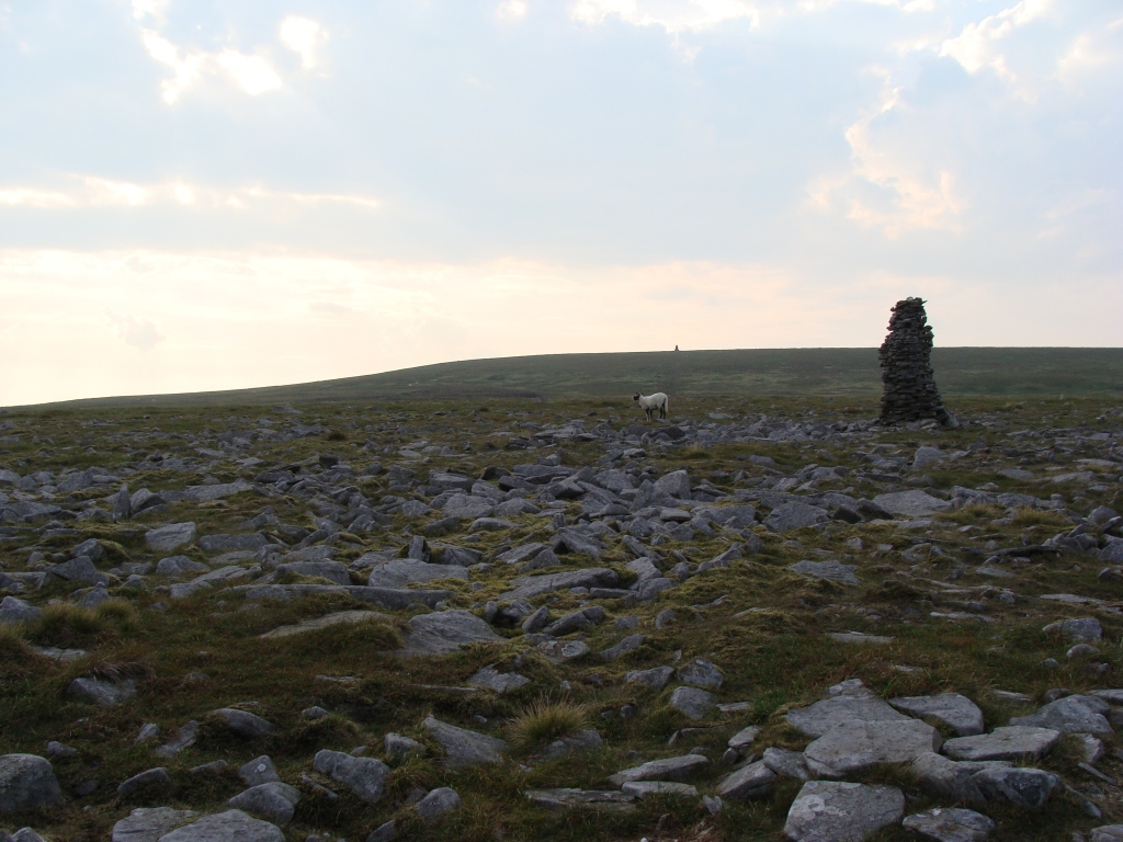
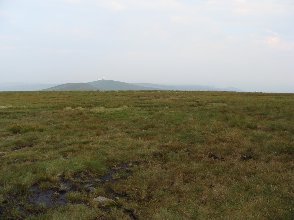
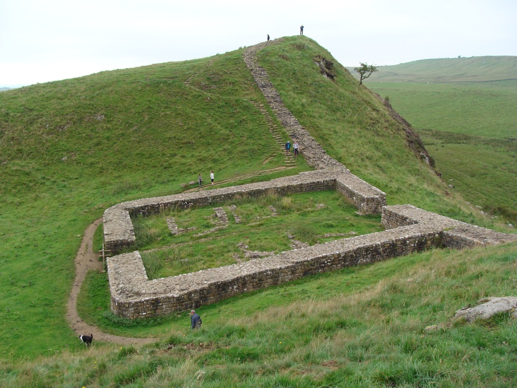
The next so many miles were a roller-coaster of up and down three more summits; Great Dunn Fell with its masts and domes, Little Dunn fell, and finally the well-known Cross Fell, at 883 m the highest of the Pennine Hills, often haunted by the notorious Helm wind. Walking across its large rocky summit plateau was a fantastic experience, with clouds high above threatening thunder, hazy views of the big fells all around, a short-eared owl doing its hunter's sky-dance, and no other hikers enjoying the views or taking a break at the summit shelter.
A short time later, when making my way down the boggy hillside to the track leading to Gregg's Hut, another hiker appeared from behind, walking at great speed. The hiker introduced himself as B and we would see each other again at the hut. Later (back home) I realised this was the same hiker I photographed in the morning, making his way from Middleton to Dufton, then on to Cross Fell.
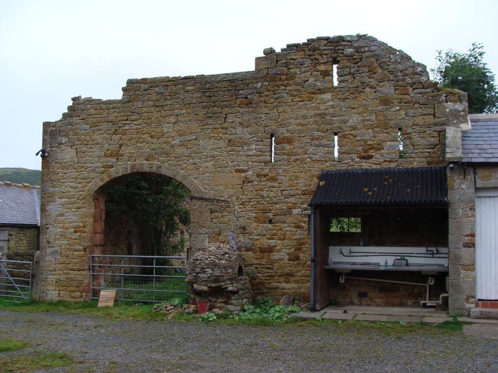
Not long after I got to Greg's Hut, a remote mountain bothy and welcome refuge, well-known by PW hikers and Spine racers. After a chat with B, I pitched the tent a little way from the hut, sorted my stuff and prepped and ate some food while watching the evening sky. I felt pleased that I'd completed this section of the walk without any problems. It had been a hot and mostly windless day, but quite dry underfoot and the navigation (fairly) easy.
My camp at High Cup
High Cup
High Cup
A wind-swept selfie
A collection of pics from High Cup:
High Cup
High Cup
High Cup
High Cup
High Cup
High Cup
High Cup
High Cup
High Cup
High Cup
High Cup
High Cup
High Cup (a zoomed-in pic of PW hiker B.)
High Cup
Leaving High Cup to follow the Maize Beck to Great Rundale Tarn.
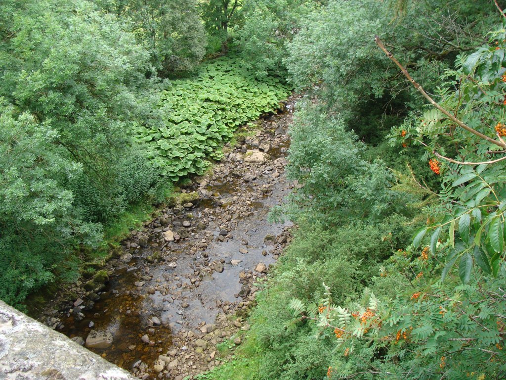
The Maize beck
The Maize beck
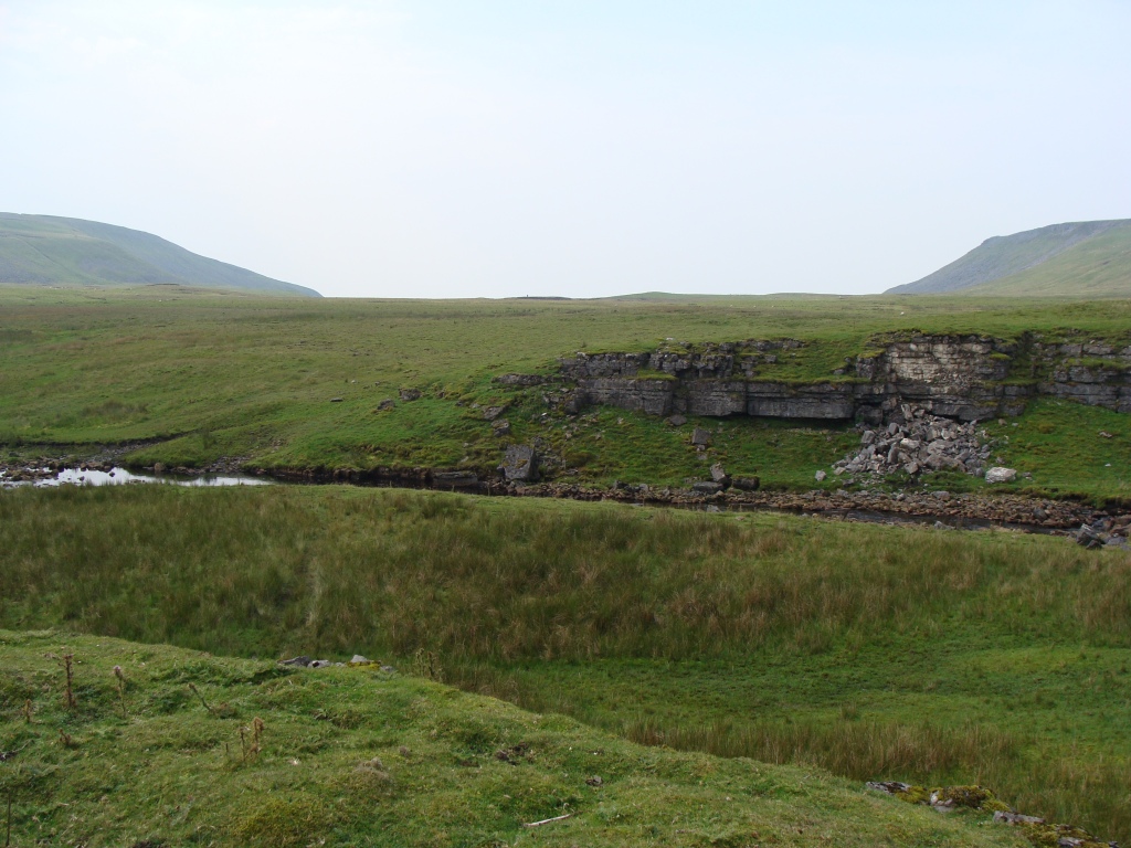
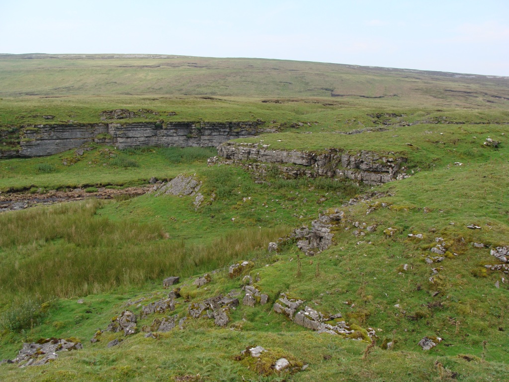
The maize Beck Scar
The maize Beck Scar
The maize Beck Scar
The maize Beck Scar
Following the stream across Dufton Fell to Great Rundale tarn:
The maize Beck
Dufton Fell
Dufton Fell
Dufton Fell (a rough 4x4 track)
Dufton Fell
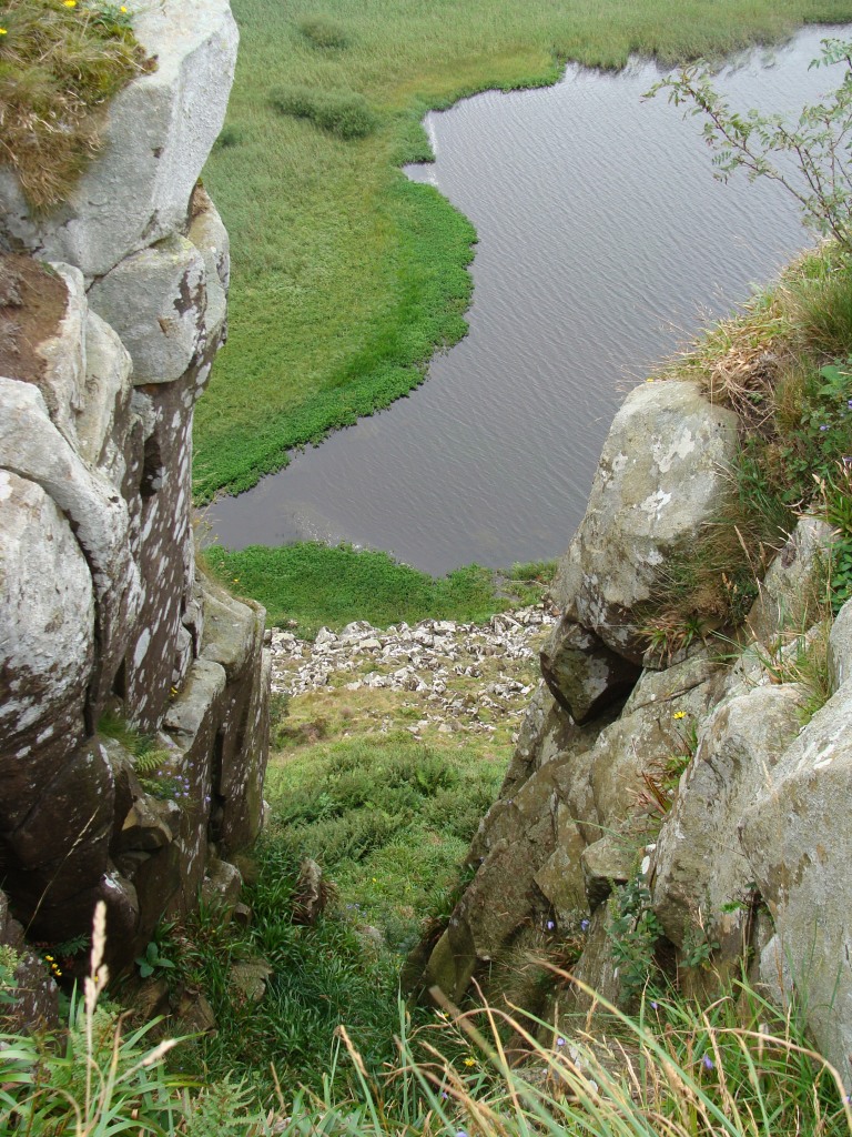
Great Rundale Tarn
The shooters hut
From the hut the route went across the moor (including streams, peat hags and bog) to the grassy summit of Knock Fell. A compass was needed for this stretch.
Knock Fell (looking back at Great Rundale Tarn)
Knock Fell (looking back at Blackstone Edge)
Knock Fell (looking ahead at the Dunn Fells and Cross Fell)
A Currick on Knock Fell
Great Dunn Fell
Great Dunn Fell
Great Dunn Fell
Dude woz ere!
The spheres on Great Dunn Fell
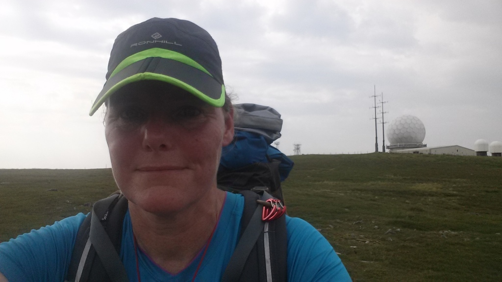
Great Dunn Fell (Serious selfie)
Great Dunn Fell (looking ahead at Little Dunn Fell and Cross Fell)
Looking back at Great Dunn Fell
Going up Little Dunn Fell
Looking back at Great Dunn Fell
A signpost: where the PW crosses the PBW.
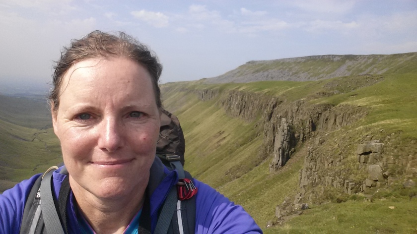
Cross Fell (looking back at the Dunn Fells)
Cross Fell
A Currick on Cross Fell
Cross Fell (a short-ear owl hunting)
Cross Fell (dramatic skies awaiting thunder)
Cross Fell (looking back at the Dunn Fells)
Cross Fell (summit trig-point)
Cross Fell (a happy selfie)
Cross Fell (summit shelter)
Cross Fell (summit trig-point)
Cross Fell (going down to Greg's Hut)
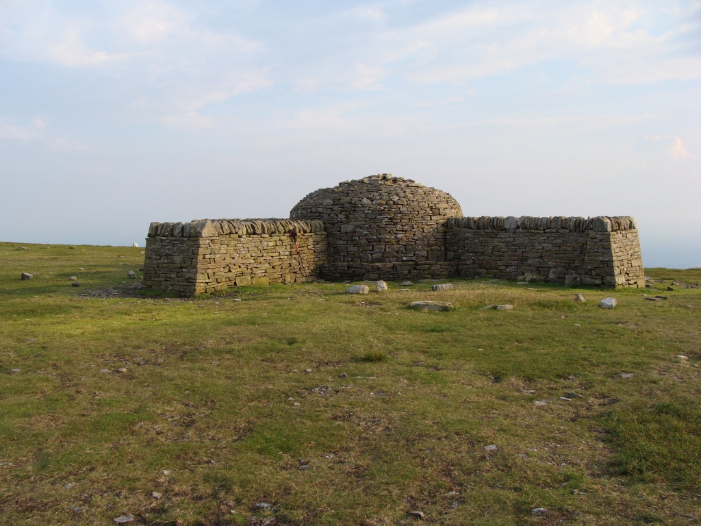
Cross Fell (Greg's Hut)
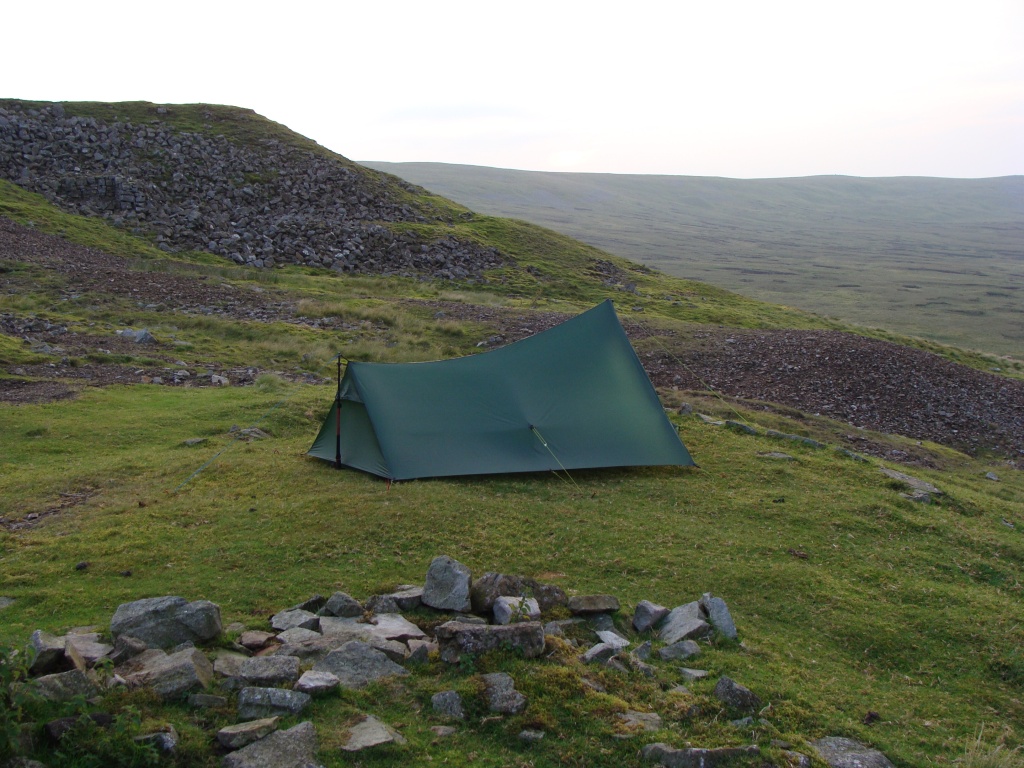
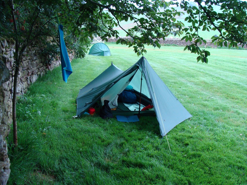
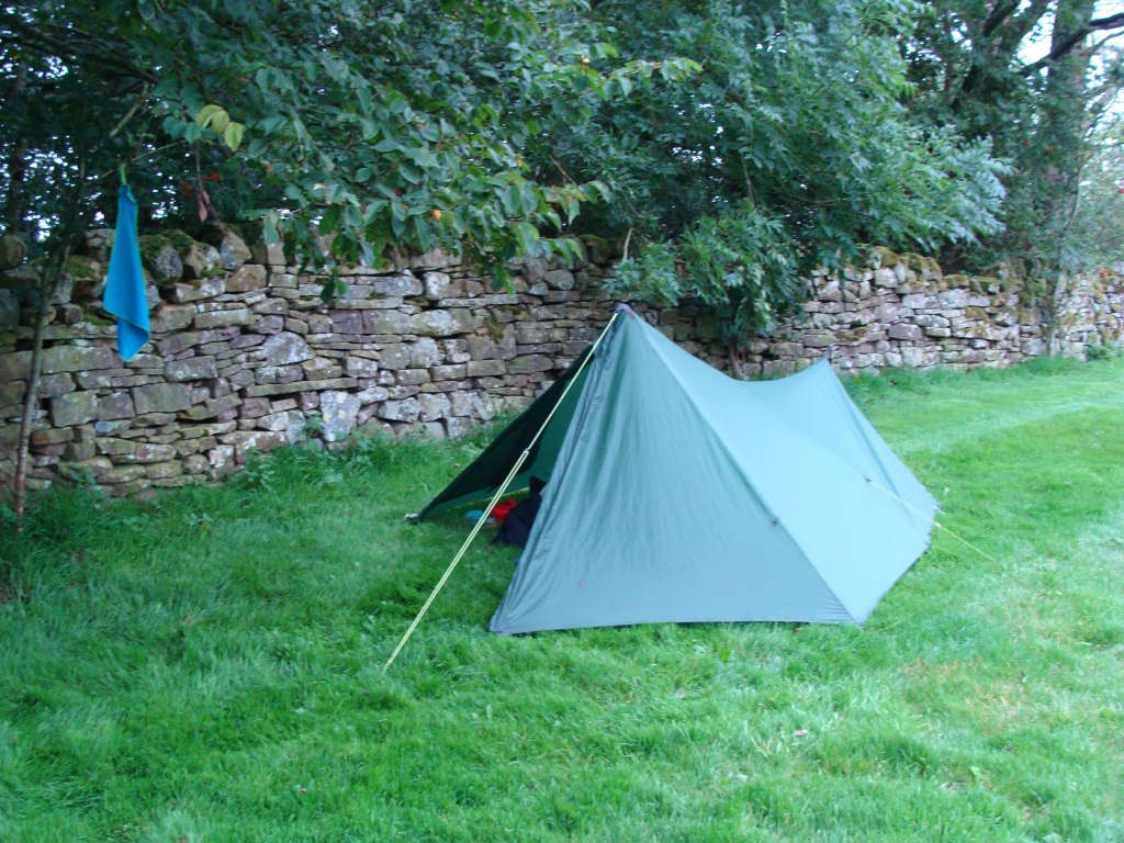
Cross Fell (my camp by Greg's Hut)
Cross Fell (my camp by Greg's Hut)
Cross Fell (Greg's Hut)
Cross Fell (Greg's Hut)
Cross Fell (Greg's Hut)
Cross Fell (my camp by Greg's Hut)
Day three: Greg's Hut to Alston 10.5 miles.
Weather: sunny, hazy, hot and humid.
A day of: following the never-ending feet-destroying Corpse Road to Garrigill, with the sun relentlessly burning down defying layers of sun-cream, meeting up with B and C at the cafe, being paced into Alston by the two faster walkers across fields, river paths and many stiles, resupplying in the Co-op, and cheekily pitching along the river on the village green.
(The campsite (shut due to covid-19) owns the strip of land by the river and gave permission.)
Highs:
extensive views across the hills and valleys
walking in good company
tea, fizzy pop and ice cream
a scenic walk along the river
fish n chips
meeting Alston's summer tent dweller and nice chap Teapot
a comfy and scenic pitch
Lows:
very hot and humid weather
very sore feet
PW4 day 3
PW4 day 3
Diary day 3: the never-ending track.
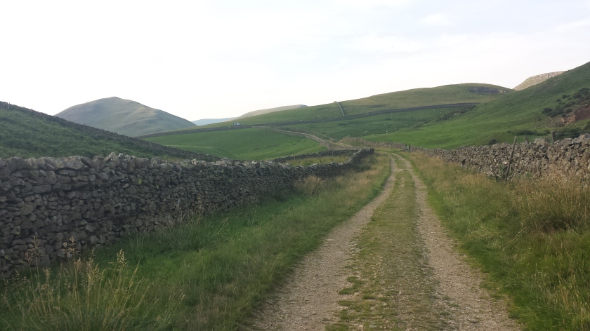
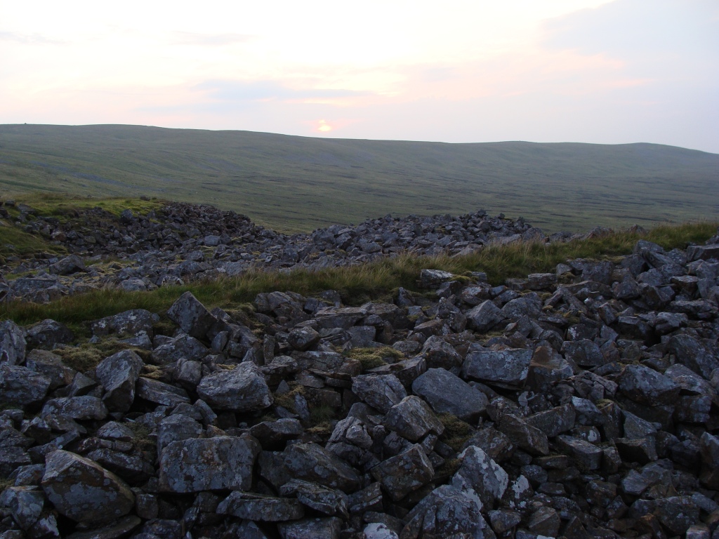
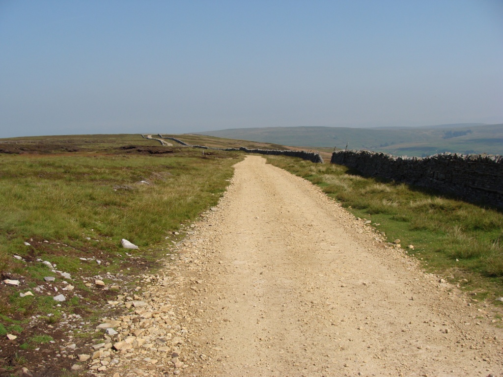
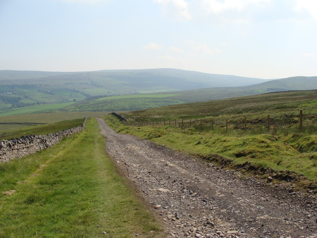
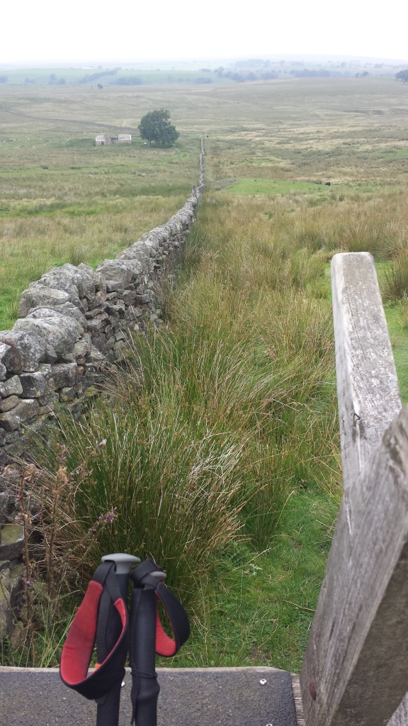
After breakfast I set off alone along the Corpse Road, the long stone track that runs across the fells from Garrigill to Kirkland. B was in no hurry after his long hike the previous day. The walking was straightforward but hard underfoot on the stony track. When I got to the remains of an old lead mine I looked for pieces of purple or blue fluorite and picked up a few bits to take home.
A few miles later I sat on a comfy grassy lump to give my aching feet a rest and have a drink and snack. B had been approaching fast and overtook me at this point, he slowed down to exchange a few words, then quickly strode on while listening to his radio. After a little while I resumed my slog on the stony track, with the sun burning hot above and not much of a breeze to cool me down.
I listened to music while enjoying the views of endless hills all around and the South Tyne Valley appearing to the east. In the simmering heat a chap was rebuilding a dry stone wall, totally absorbed in his craft. The last bit of the Corpse Road was the hardest as it was steeper and rougher underfoot, and my feet had enough of it.
Finally I was walking on level tarmac through the pretty hamlet of Garrigill, looking for a cafe or shop to buy food and drink, or just somewhere comfortable to sit out of the sun. I made for some benches under trees on the village green, then spotted B having a cuppa at one of the picnic tables. I joined him, then ordered a pot of tea, a soft drink and some chocolate from the post-office shop.
Not long after I noticed another hiker approaching who I recognised from a social media hiking group. We called him over and the three of us had a good chat about our journeys. The hiker, C, had come from Dufton and was moving fast and light, but not camping.
After our much needed and well-earned break we hiked together, roughly following the river into Alston. The route was not as straight forward as I'd anticipated, taking us up and down across fields, over stiles and through gates, before getting to Alston. In Alston everything is either steeply up or down as the town was built on a hillside. C went to his accommodation and B and I dragged weary legs up to the village shop to resupply for the next few days, as there are no more shops till Haltwhistle (out of the way) or Bellingham.
After shopping, ice-cream and pop, we decided to check out the campsite. The site was closed, but the owner gave permission for us to camp by the river on a narrow strip of land she owns between the village green and the river. It was a strangely exposed but scenic pitch, made suitable after finding spaces big enough for the tents and clearing dog poo and conifer cones.
After pitching I walked into town to get some dinner. As all the pubs were fully booked I ended up having fish n chips. While waiting for my order I noticed an interesting looking chap talking to the locals. I found out he was the occupant of another tent we noticed pitched by the river. He called himself Teapot and usually spends his summers in his tent in Alston not having anywhere to call home.
We enjoyed a long chat with him about life's trials and tribulations. A few local dog walkers also came over for a chat or a nosy, the dogs receiving a few cuddles as we both missed our furry friends. I slept well listening to the sound of the river making its way from the fells to the sea.
The Corpse Road to Garrigill.
The Corpse Road (looking back at Greg's Hut)
The Corpse Road (looking back at Greg's Hut)
The Corpse Road (looking back at the high Fells)
The Corpse Road
Old mining works where bits of fluorite can still be found lying on the surface.
The Corpse Road
Hazy views of the big fells all around
The Corpse Road (looking at the route ahead)
The Corpse Road (old (lead) mining works)
The Corpse Road (looking back )
The Corpse Road (looking back at Cross Fell)
The Corpse Road (a small quarry)
The Corpse Road (a few more miles to go)
The Corpse Road (finally Garrigill comes into view)
The Corpse Road (a bit more to go)
The Corpse Road (the last painful bit)
Garrigill (meeting up with B and C)
The river South Tyne
The river South Tyne (B and C crossing the footbridge)
The river South Tyne
The river South Tyne
Alston (our camp by the river)
Alston (seen from our camp)
Day four: Alston to the Hartley Burn stream (Lambley) 11 miles.
Weather: cloudy with a few sunny spells, cooler.
A day of: marching along the south Tyne Trail to the awe-inspiring Lambley viaduct, plodding solo onwards across fields and bog to find a suitable place to pitch, finding a good spot in a scenic river valley dotted with trees and inhabited by large lazy cattle and tiny tormenting midges.
highs:
great conversations and a few laughs along the trail
cooler weather conditions
nice views of farmland, small gorges and bridges
awesome views from the Lambley viaduct
a comfy secluded pitch by the stream
Lows:
very sore feet
PW4 day 4
PW4 day 4
Diary day 4: train spotting.
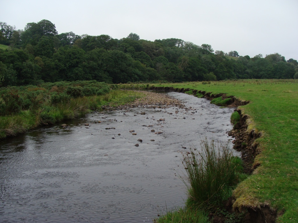
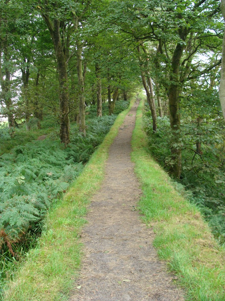
After a bit of a lie-in and a few interesting chats to locals, we packed up and headed for the little train station to walk along the South Tyne (and Pennine Journey) Trail, which goes all the way to Haltwhistle. Due to the pandemic no trains were running, but a few volunteers were busy doing maintenance. The trail runs parallel to the river and several times the PW trail crosses it.
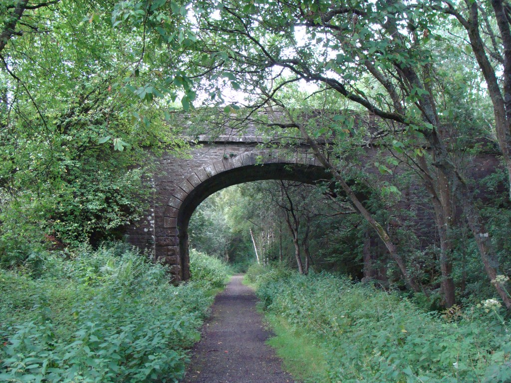
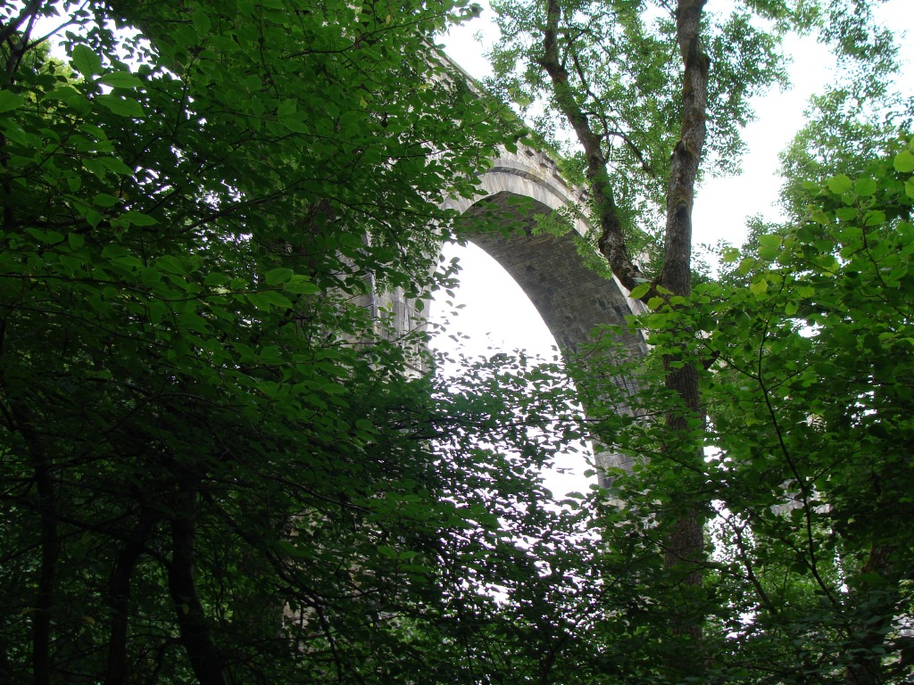
The level paved surface meant we made good progress, and soon found ourselves in Lambley with the impressive viaduct looming ahead. This is where B would rejoin the PW heading for Greenhead, and leave me to have a look at the viaduct and find somewhere to camp.
The viaduct is worth a detour from the trail as the structure itself, and the views from underneath and from the top, are fantastic. To access the viaduct some very steep steps need to be climbed, which after 9 miles of easy but fast walking, came as a bit of a shock to my legs. I spent some time walking along the viaduct admiring the views of the wooded South Tyne valley, the river and pebble beaches below, and taking pictures.
As it was still relatively early and I could not spot any suitable places to camp without having to walk a fair bit in the wrong direction, I decided to push on a bit. Following the footpath to Lambley village, and seemingly through people's back gardens, I joined up with the PW again.
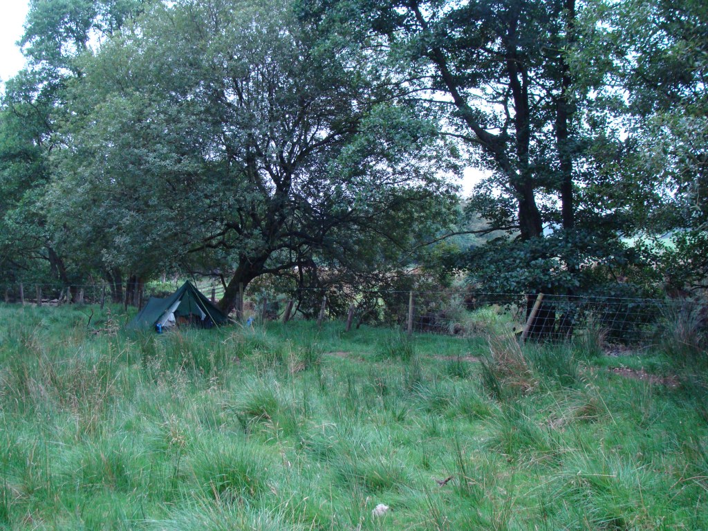
The pleasant meadows gave way to rough boggy pastures, and I wondered how far I'd have to walk before I'd come across somewhere flat, dry and secluded to camp. The map showed a small river valley a few miles from Lambley which looked suitable.
The valley was near perfect with flat grassy meadows, grazing cattle looking chilled and quite a few broad-leaved trees. Being careful I tucked the tent out of sight of any walkers passing through, a wise decision as later on a farmer drove by on a quad bike to check his sheep and cattle. It felt strange being on my own again after almost 2 days of trail company.
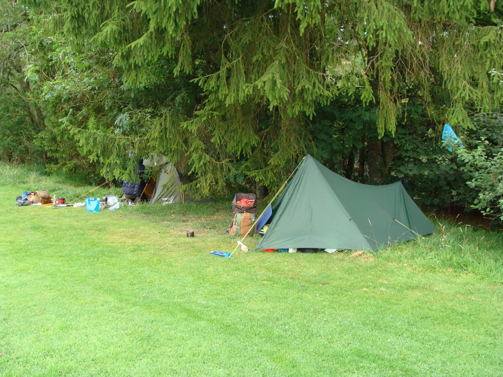
Our camp in Alston.
Our camp in Alston
We decided to have an easier day and follow the South Tyne/Pennine Journey Trail to Lambley.
Alston Railway Station
Alston Railway Station
The river South Tyne
The river South Tyne (setting off along the ST Trail)
The river South Tyne
The South Tyne Trail
The South Tyne Trail (lush meadows and happy cattle)
The South Tyne Trail
The South Tyne Trail
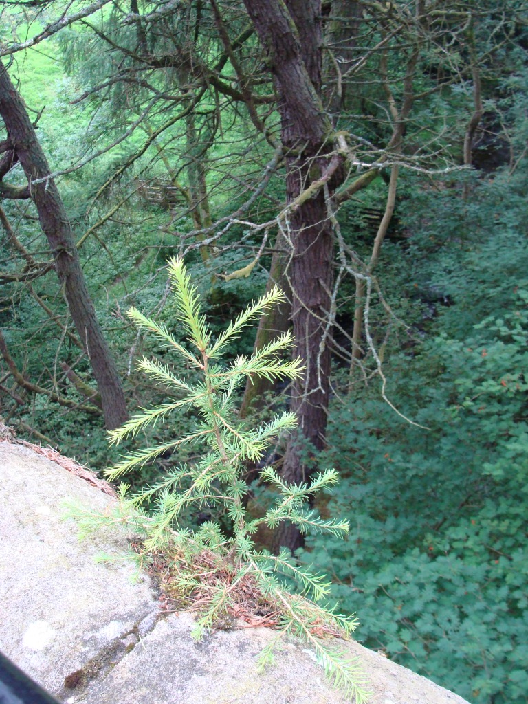
The South Tyne Trail (a small Larch tree clinging on)
The South Tyne Trail (Slaggyford Station)
The South Tyne Trail (Slaggyford Station)
Slaggyford?
The South Tyne trail
The Lambley Viaduct; well worth a detour from the PW route.
Underneath Lambley Viaduct.
Underneath Lambley Viaduct
Underneath Lambley Viaduct
The Lambley Viaduct
The Lambley Viaduct (views north)
The Lambley Viaduct (views south)
The Lambley Viaduct
Back on the moors after Lambley village
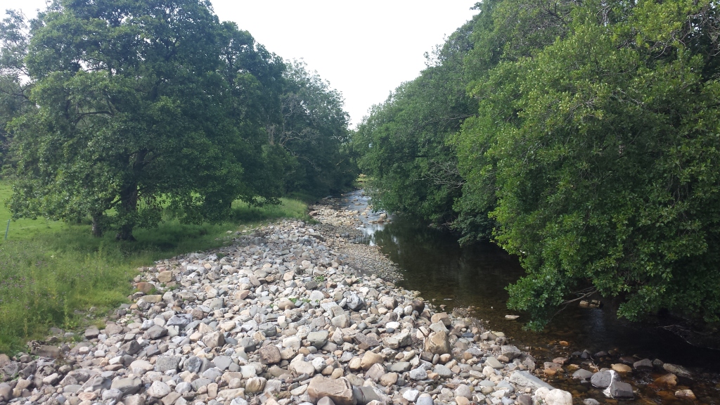
The Hartley Burn
The Hartley Burn, which flows from the Pennine fells into the river South Tyne.
The Hartley Burn
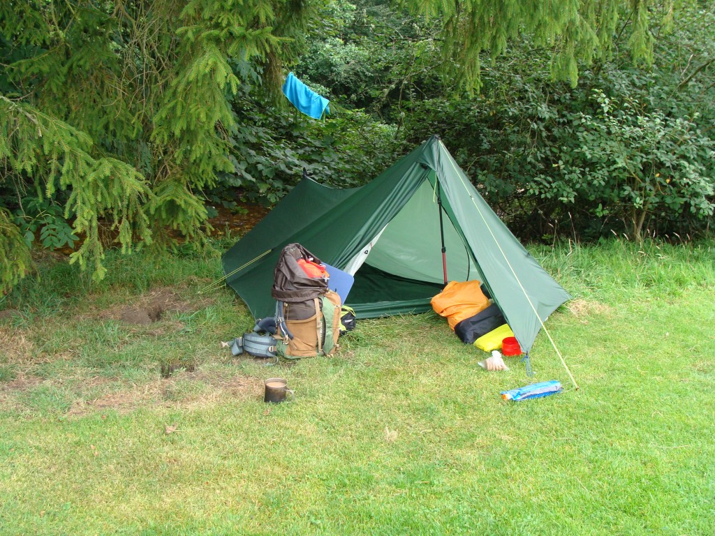
My camp by the stream
My camp by the stream
My camp by the stream.
Day five: Hartley Burn to Cockmount Hill (Hadrian's Wall) 9 miles.
Weather: cloudy and cool, a little breezy.
A day of: bog plodding across the swampy expanse of Blenkinsopp Common, a proper meal in Greenhead, a steady march following the contours of Hadrian's Wall in the noisy company of other walkers, having a quick chat to two other solo PW walkers carrying heavy bags and looking determined, finding a near perfect pitch in a small woodland with a funny name.
Highs:
decent weather
a good meal
nice views
Roman ruins
great pitch
Lows:
leaving the Pennines
lots of people
noise
sore feet
PW4 day 5
PW4 day 5
Diary day 5: swamp and stones.
After breakfast and packing up, I followed the pretty river along a meandering path back to a footbridge, where I re-joined the PW. After a steep climb out of the valley, the path took me across farmland, then to the notorious Hartleyburn and Blenkinsopp Common.
Somewhere I took a wrong turn and ended up walking across some very marshy terrain, eventually heading for a wooden footbridge crossing a stream. Then more pathless marshland, over a stile near the trig on Black Hill, finally reaching dry land on the other side of the stone wall. I tried following a few vague trails heading north off the hill, but found it easier using mobile GPS and compass to make my way to the A69.
Seeing but not hearing the busy A-road, as I was listening to music, first made little sense. Lots of fast movement along a black ribbon dissecting the landscape in front. The next obstacle was the golf-course, I felt a bit awkward walking through it as I couldn't see any paths or signposts.
At the little bridge crossing the Tipal Burn I decided to take the footpath to Greenhead and have lunch in the cafe. While having my meal outside at the picnic table I noticed another PW hiker with a large pack. I left him to it as he was busy writing his notes and I needed to air my feet after walking through the marshy bog on Blenkinsopp Common.
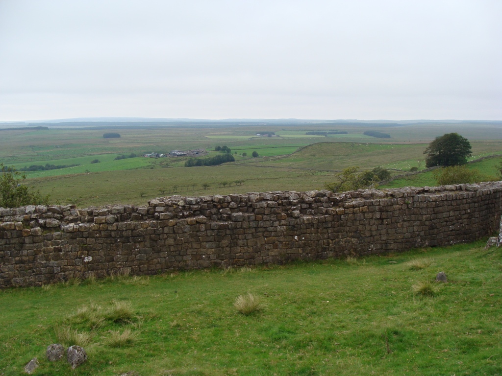
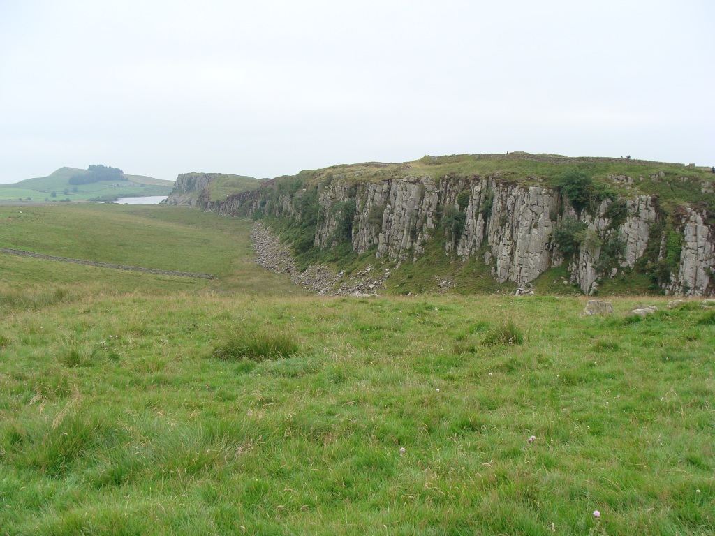
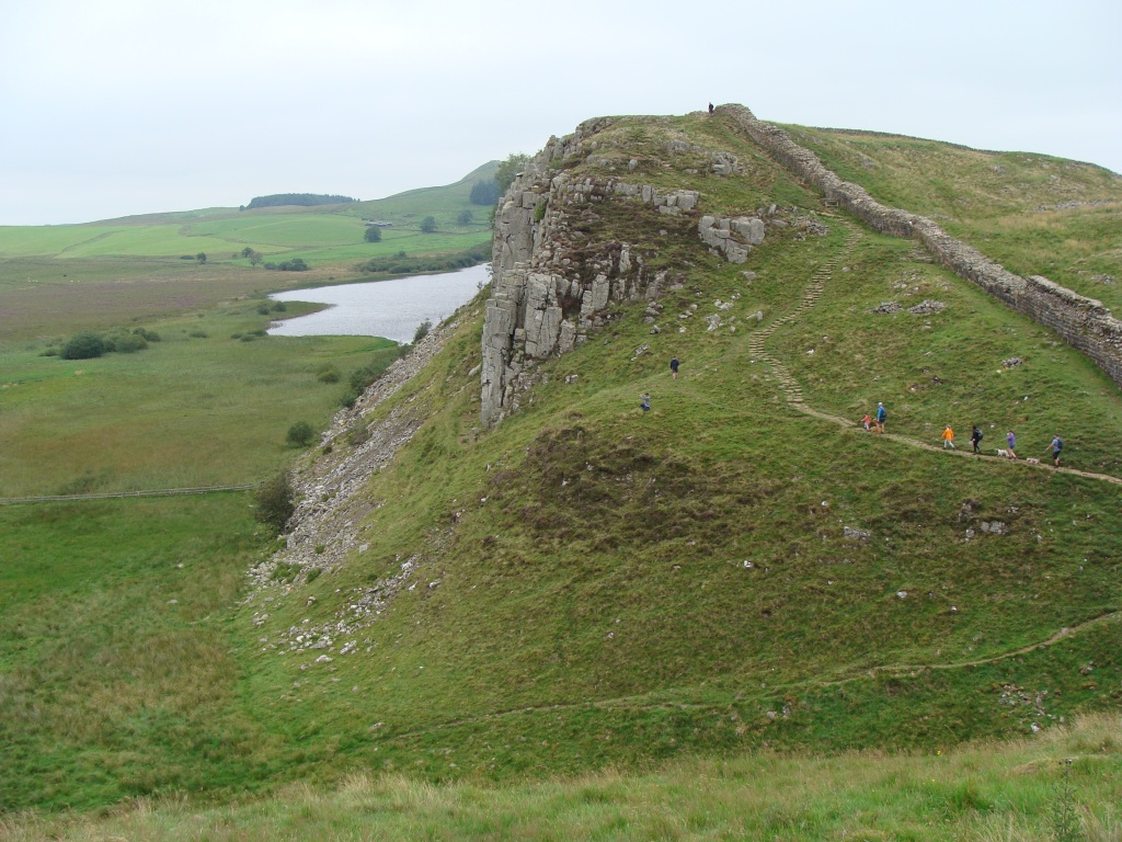
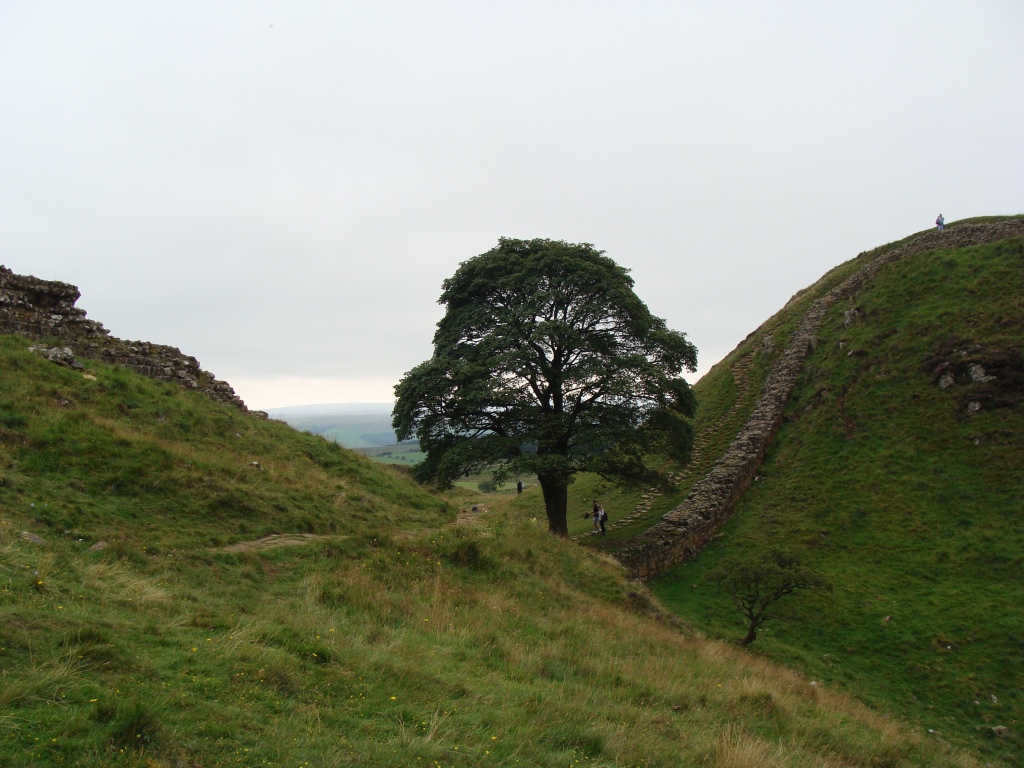
After lunch I walked back to Holmhead and headed for the Hadrian's wall. First past the ruins of Thirlwall Castle, built with plundered stone from the Wall, then a few steep climbs up the hill to the remains of a quarry, now a nice park, then the impressive looking Walltown Crags. The weather was okay, so I was lucky to get decent views of the Wall east and west, and the big border forest north.
After a few miles the trail went through a small woodland and I decided to stop there for the night, seeing no point in continuing after coming across such a nice place, and I'd walked enough miles. Just then the PW hiker I'd seen at the cafe overtook me, we had a little chat and wished each other well.
I tried to pitch the tent out of the way, then set about finding water. I'd made the classic mistake again of not carrying enough or refilling when possible. The map showed a small stream down the hill but everywhere was bone dry. Then I noticed a heavy duty hose used for filling water troughs. Opening the valve proved tricky, but I succeeded after a struggle, which resulted in a unwanted high pressure shower.
Feeling embarrassed I looked around for any bemused spectators (or angry farmers), but my unexpected dousing did not seem to have been noticed by anyone except for some curious sheep.
A pleasant evening was spent watching the views, filtering water, and cooking and eating dinner.
Leaving the Hartleyburn valley
Hartleyburn/Blenkinsopp Common
Black Hill
Between the moor and the Wall.
A posse of hungry sheep
Towards Holmhead
Thirlwall Castle
Hadrians Wall
Hadrians Wall
Hadrians Wall
HW (a small quarry now a pretty lake and park near Walltown)
HW (looking down at the old quarry)
Hadrians Wall
Hadrians Wall
HW: a small quarry past Holmhead.
HW (my camp in the woods)
HW (my camp in the woods)
Day six: Cockmount Hill to Housesteads to Winshields Campsite 10 miles.
Weather: cloudy and cool, a little breezy, a little rain.
A day of: more marching along the Wall and dodging the tourists, taking lots of pics of old stones, refusing to queue to pay £8 to see more stones, walking the roman road to Winshields Farm to camp in (some) comfort, charge my phone and have a much needed shower, going hungry but having a nice pint of Sycamore Gap in the pub.
Highs:
nice views
long hot shower
good pint in the pub
Lows:
lots of people
traffic
walking 3 miles along a fast road
just crisps and oatcakes for dinner
PW4 day 6
PW4 day 6
Diary day 6: stones and people.
Quite early in the morning a group of DofE lads strode past on the path some distance from the tent. The boys, engrossed in chat and hiking fast, never noticed the tent in the woods. After my morning routine, I set off on the last leg of my PW4 journey, the 7 miles to Housesteads.
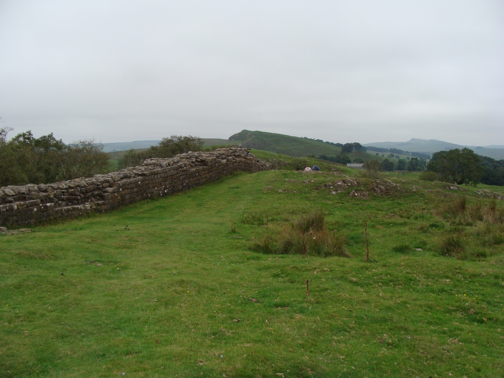
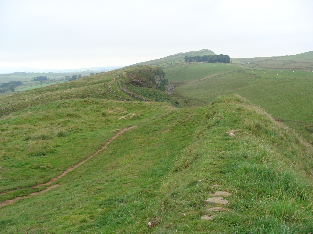
The path followed the natural winstone escarpment with the Wall running alongside and several very steep up and downs connecting the craggy areas. This was a popular section of the trail for day-trippers, and the number of hikers along the trail increased from a few lone figures to crowds of people taking pics of all the interesting features of the Wall.
Suddenly being among lots of people all chatting away was a bit overwhelming and I longed for the relative solitude of the fells and moors. I did have a nice talk with a family walking the whole HW trail, the kids happy and exited about their adventure and were used to hiking.
Along Hadrians Wall I came across several visitor centres, which had decent toilets and handy taps for washing hands and filling up water bottles, a nice bit luxury for trail-hikers.
Just past Highshields Crags I met PW hiker D who I also recognised from social media. D had spend several days walking with B, and we briefly chatted about the trail and the people we met, before he trooped on towards Bellingham.
It seemed everyone I met walked a lot faster than me and carried a much heavier pack, which made me feel my trip was just an easy bimble compared to the thru-hikers' longer tougher journey. Which is nonsense really, everyone is different, takes on their own challenge and hikes their own hike.
When I got to Housesteads I decided not to join the queue for the museum and ruins, and had a sit-down with boots off instead. After a rest I made the choice to walk to the road below and hike a further three miles to Winshield Farm campsite. I wanted a shower before going back home on the train, some food and needed to charge my phone.
At the bottom of the hill was the visitors centre with a nice looking cafe. The cafe staff decided to close early and literally shut the door in my face, annoying not just myself, but a group of other visitors as well. Thankfully the toilets were still unlocked, as there was nowhere to go without being seen by the many tourists.
The walk along the B-road to Winshields Farm was unpleasant as the cars drove very fast along the former roman road and the verges were soft and overgrown. It was also strange more or less back-tracking the route just walked. The campsite however was really nice, the owner helpful and friendly, and soon I was pitched in a corner of a small field.
After showering and putting on my clean spare clothes, I went to the pub down the road for a pint and a meal. I got my pint but no food as you needed to book ahead. So I dined on crisps and oatcakes instead, knowing tomorrow I could eat in town or on-route. A comfortable night was spent on this quiet little campsite.
Hadrians Wall
HW (looking back at Caw Gap)
HW (looking west)
Hadrians Wall
HW (Winshields Trig (345 m)
HW (Peel Crags)
HW (Highshields Crags)
HW (looking west)
HW (Milecastle 39)
HW (Milecastle 39)
HW (Sycamore Gap)
HW (Highshield Crags
HW (Sycamore Gap)
HW (Sycamore Gap)
HW (looking north)
HW (looking west)
HW (looking down from the crags)
HW (looking down from the crags)
HW (Highshields Crags and Crag Lough (the lake)
HW (looking north to Wark Forest)
HW (Housesteads Crags)
HW (the end of my journey north)
HW (looking east)
HW (Housesteads - Vercovicium)
HW (the Housesteads museum)
My tent at Winshields Farm
My tent at Winshields Farm.
The Twice Brewed pub
A well-earned end-of-trip pint of "Sycamore Gap" in the Twice Brewed pub.
Day seven: Winshields Farm - Bardon Mill - home.
Weather: cloudy with a little sunshine, cool, a little breezy, a little rain.
A day of: climbing up to Winshields Crag to say goodbye to the the trail, three miles of road walking into town, train travel, a big lunch in Carlisle, more train travel, eventually arriving home in Worcestershire.
PW4 day 7 home
Diary day 7: rain and train.
It had rained in the night so for the first time this trip I packed away a damp tent and wore my jacket. The owner kindly charged my phone while I had a wander around the farm taking photos of the old barns and walking up to Winshield trig to look at the views and say goodbye to the trail.
Then it was a fast march along the lanes to Bardon Mills to catch the mid-morning train to Carlisle. While waiting at the station it started to rain. I had been very lucky this time with the weather. Good weather means good visibility and great views, makes camping and hiking a lot easier so much more enjoyable.
At Carlisle I gave myself an extra hour to go into town to have lunch. The man preparing my baguette chuckled as he eyed-up the hungry hiker. I'm sure I could've eaten two as the appetite had switched from almost zero (survival mode) to ravenous.
The train journey home was quiet and pleasant, wearing the mask for many hours not that much of an ordeal. I got home at 6 pm, in time for a warm welcome and home-cooked Sunday roast, and back to the hustle and bustle of everyday life in a small town.
Winshields Farm
Winshields Farm
Winshields Farm
Winshields Farm
A last look at the Wall and the land beyond.
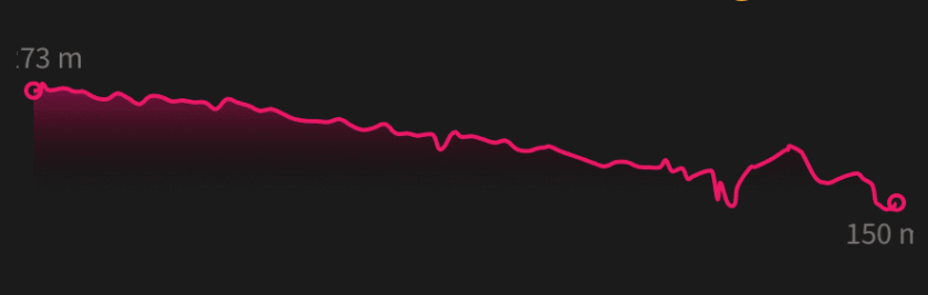
Hadrians Wall gradient
Trivia: the roller-coaster gradient of Hadrians Wall from Holmhead to Housesteads, about 9 miles.
Thanks for reading! 😊
Taz 2020
➖➖➖➖➖➖➖➖➖➖➖➖➖➖➖➖➖➖➖➖➖➖➖➖➖➖➖➖
Trip Highs:
being able to physically do it
meeting great people
fantastic views
sleeping under the stars
good weather
comfortable train journeys
Trip lows:
(unexpected) blisters
having to finish at Housesteads
Why blisters? I'd been using trail shoes with soft insoles for many months, but decided to use my Salomon Quest boots with my (hard) orthopedic insoles. The boots had been worn on many backpacking trips with no issues, but after wearing the trail shoes my feet were no longer used to the hard insoles. It had also been very warm making my feet sweat and swell despite airing them several times a day.
Socks: as it had been a dry summer I took 2 pairs of normal hiking socks (Bridgedales), and a thin liner sock + waterproof sock (Dexshell) combo. The waterproof socks had served me well on many other trips (in wet conditions), but almost gave up crossing Blenkinsopp Common, a few miles of grassy marshland.
Backpacking solo: I usually travel alone or with my dog. I enjoy the experience of becoming part of the landscape and the temporary escape it offers to be away from the busy world of people. I'm rarely worried or scared, as there is little danger apart from accidents or extreme weather against which you can take (some) precautions.
Trail angst: my biggest worry is getting wet-through on multiple rainy days when drying clothes is not an option. I try not to escape into a hostel unless absolutely necessary. Its taken a few years of practice to have gear I trust and the knowledge of how to use it. I'm learning all the time, I'm fairly experienced but not an expert.
Bathroom habits: for my toileting needs I simply found a quiet spot then used a small trowel, some toilet paper and a poo-bag (or nappy-sack). For keeping clean I used a small cloth, some liquid soap and a micro towel.
.JPG)


.JPG)
.JPG)
.JPG)
Really enjoyed your account. I’m planning a return to the PW as soon as restrictions are lifted.
ReplyDelete